80.61+/- Acres Crawford County, WI - High Point Land Company

80.61+/- Acres Crawford County, WI

  • Photos
  • Satellite
  • Trail Camera
CoverPhoto
Photo-Mar-28-2024-7-25-31-PM
Photo-Mar-28-2024-7-25-13-PM
Photo-Mar-28-2024-7-24-54-PM
Photo-Mar-28-2024-7-24-38-PM
Photo-Mar-28-2024-7-24-19-PM
Photo-Mar-28-2024-7-23-34-PM
Photo-Mar-28-2024-7-23-26-PM
Photo-Mar-28-2024-7-22-54-PM
Photo-Mar-28-2024-6-58-24-PM
Photo-Mar-28-2024-6-58-21-PM
Photo-Mar-28-2024-6-58-16-PM
Photo-Mar-28-2024-6-58-06-PM
Photo-Mar-28-2024-6-57-54-PM
Photo-Mar-28-2024-6-57-36-PM
Photo-Mar-28-2024-6-57-28-PM
Photo-Mar-28-2024-6-57-16-PM
Photo-Mar-28-2024-6-57-10-PM
Photo-Mar-28-2024-6-57-02-PM
Photo-Mar-28-2024-6-56-40-PM
Photo-Mar-28-2024-6-56-02-PM
Photo-Mar-28-2024-6-55-43-PM
Photo-Mar-19-2024-5-29-36-PM
Photo-Mar-19-2024-5-28-56-PM
Photo-Mar-19-2024-5-28-46-PM
Photo-Mar-19-2024-5-28-31-PM
Photo-Mar-19-2024-5-28-25-PM
Photo-Mar-19-2024-5-28-18-PM
Photo-Mar-19-2024-5-28-08-PM
Photo-Mar-19-2024-5-27-57-PM
Photo-Mar-19-2024-5-27-19-PM
Photo-Mar-19-2024-5-27-06-PM
Photo-Mar-19-2024-5-26-40-PM
Photo-Mar-19-2024-5-26-17-PM
Photo-Mar-19-2024-5-25-59-PM
Photo-Mar-19-2024-5-25-43-PM
Photo-Mar-19-2024-5-25-29-PM
Photo-Mar-19-2024-5-24-55-PM
Photo-Mar-19-2024-5-24-44-PM
Photo-Mar-19-2024-5-24-37-PM
Photo-Mar-19-2024-5-24-31-PM
Photo-Mar-19-2024-5-24-21-PM
Photo-Mar-19-2024-5-24-13-PM
Photo-Mar-19-2024-5-23-48-PM
Photo-Apr-02-2024-3-29-47-PM
Photo-Apr-02-2024-3-29-47-PM-16
Photo-Apr-02-2024-3-29-47-PM-15
Photo-Apr-02-2024-3-29-47-PM-14
Photo-Apr-02-2024-3-29-47-PM-14-1
Photo-Apr-02-2024-3-29-47-PM-13
Photo-Apr-02-2024-3-29-47-PM-13-1
Photo-Apr-02-2024-3-29-47-PM-12
Photo-Apr-02-2024-3-29-47-PM-11
Photo-Apr-02-2024-3-29-47-PM-10
Photo-Apr-02-2024-3-29-47-PM-9
Photo-Apr-02-2024-3-29-47-PM-9-1
Photo-Apr-02-2024-3-29-47-PM-8
Photo-Apr-02-2024-3-29-47-PM-7
Photo-Apr-02-2024-3-29-47-PM-6
Photo-Apr-02-2024-3-29-47-PM-5
Photo-Apr-02-2024-3-29-47-PM-4
Photo-Apr-02-2024-3-29-47-PM-3
Photo-Apr-02-2024-3-29-47-PM-2
Photo-Apr-02-2024-3-29-47-PM-1
Photo-Apr-02-2024-3-29-46-PM
Photo-Apr-02-2024-3-29-46-PM-7
Photo-Apr-02-2024-3-29-46-PM-6
Photo-Apr-02-2024-3-29-46-PM-6-1
Photo-Apr-02-2024-3-29-46-PM-5
Photo-Apr-02-2024-3-29-46-PM-4
Photo-Apr-02-2024-3-29-46-PM-4-1
Photo-Apr-02-2024-3-29-46-PM-3
Photo-Apr-02-2024-3-29-46-PM-2
Photo-Apr-02-2024-3-29-46-PM-1
Acreage
80.61 Acres +/-
Price
$649,000
State
Wisconsin
County
Crawford
ID
#56578
Description

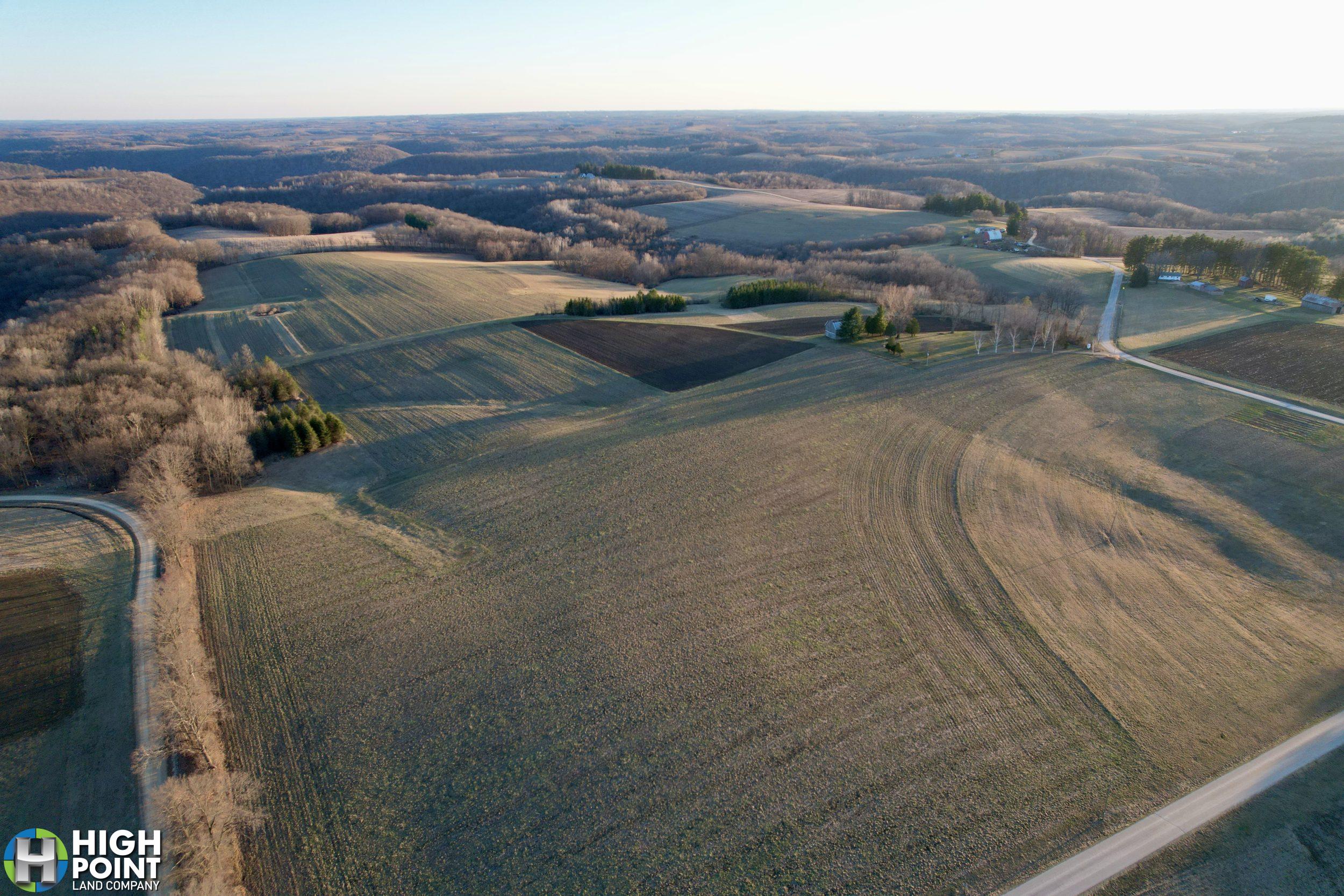
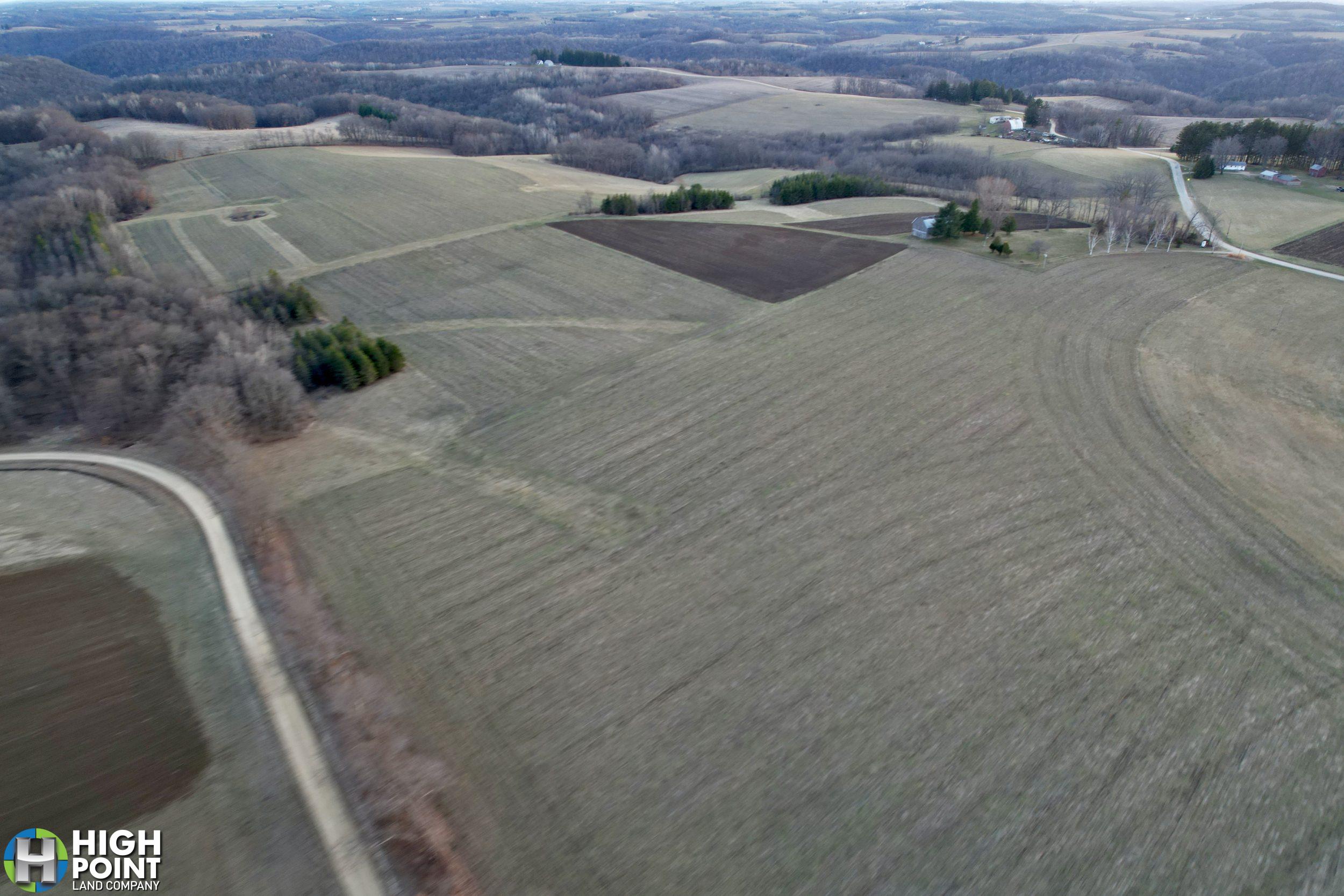
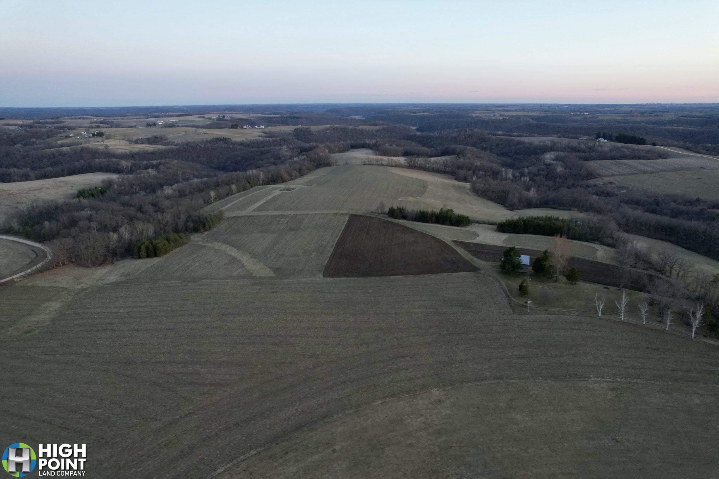
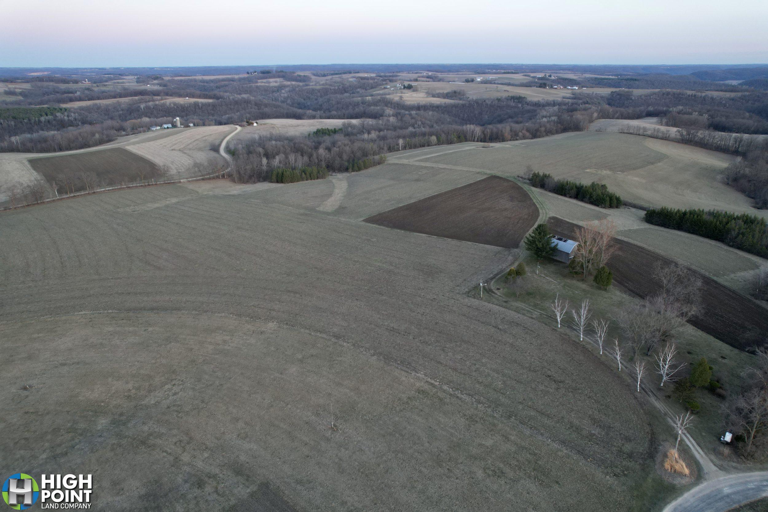
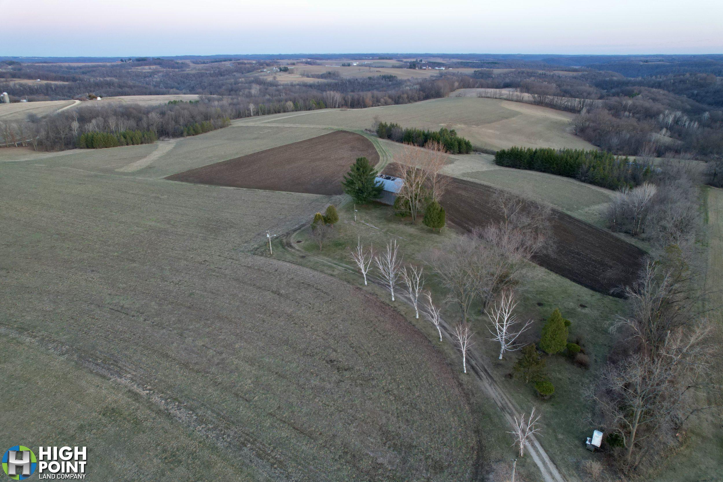
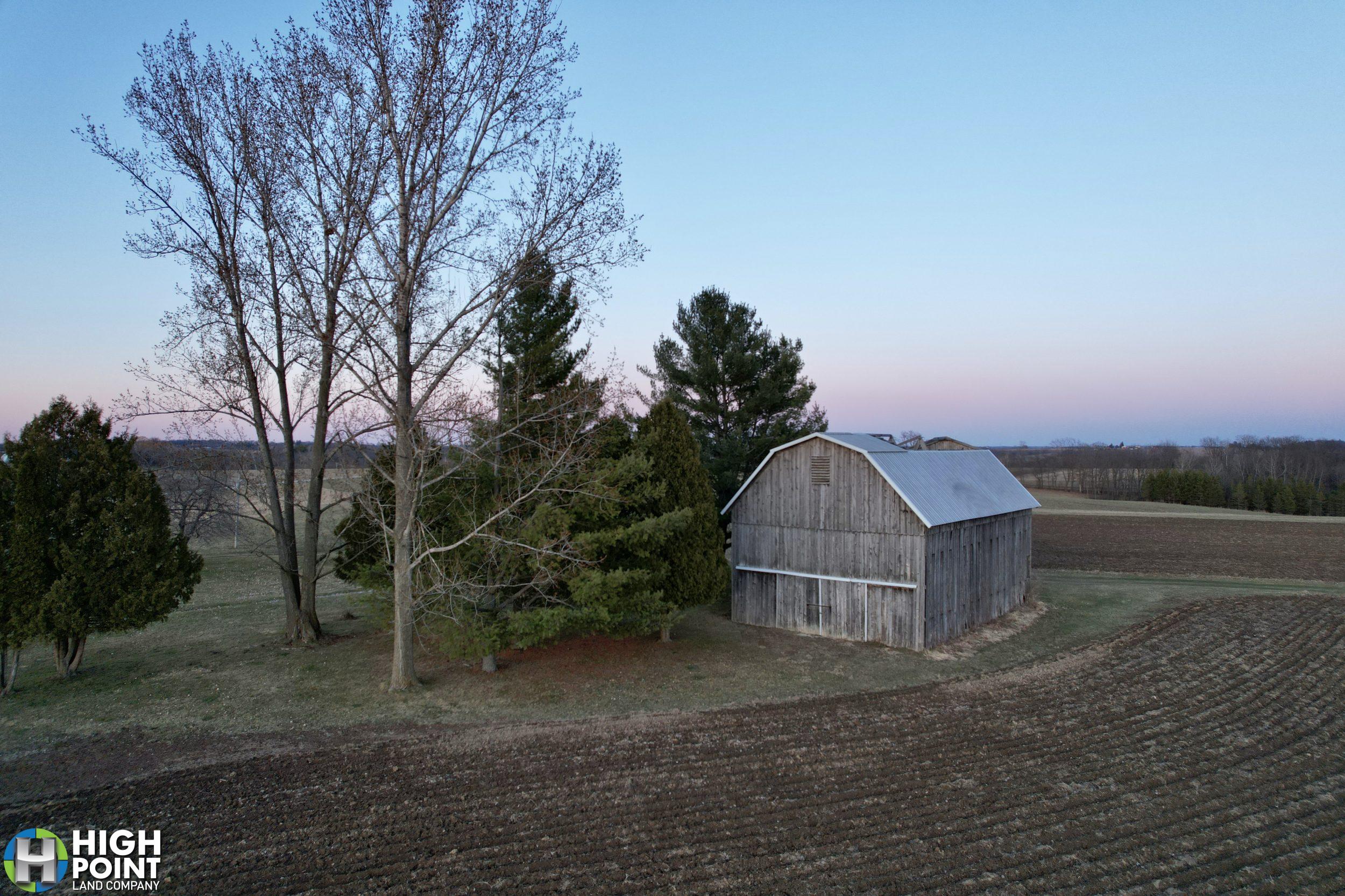
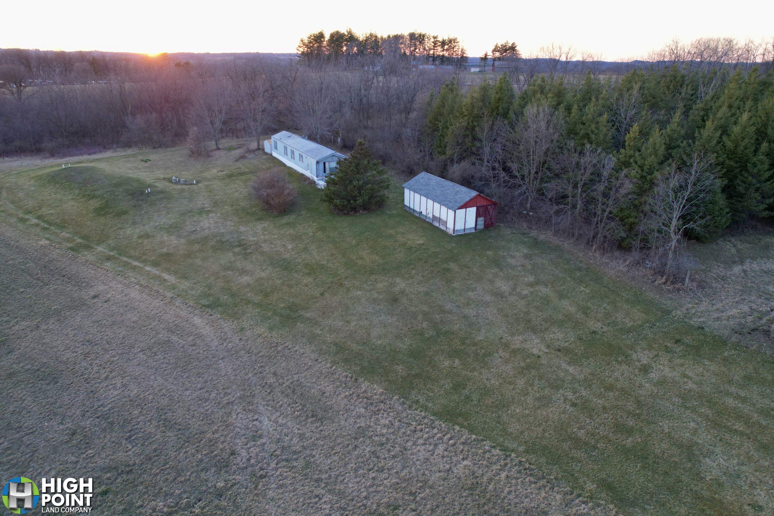
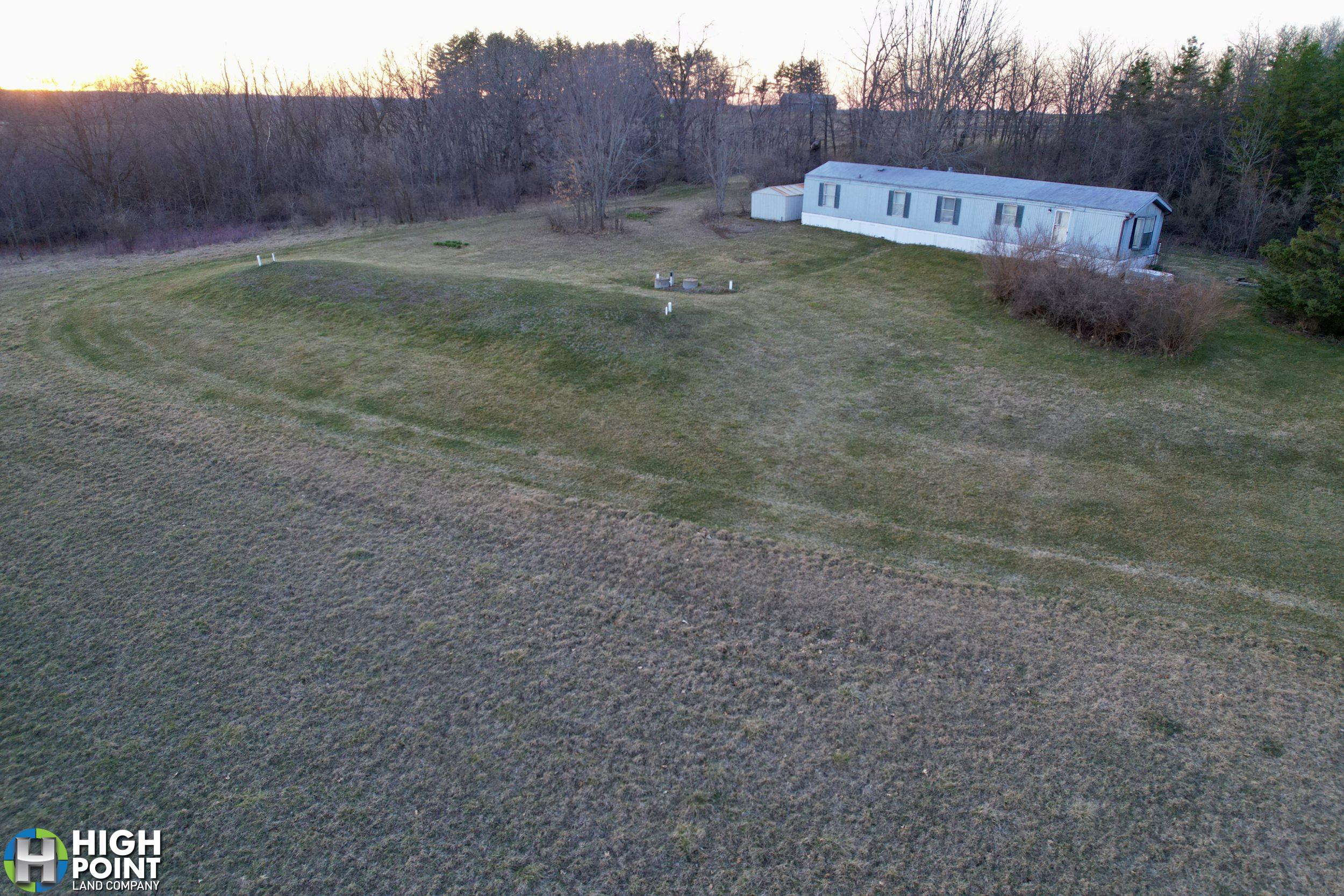
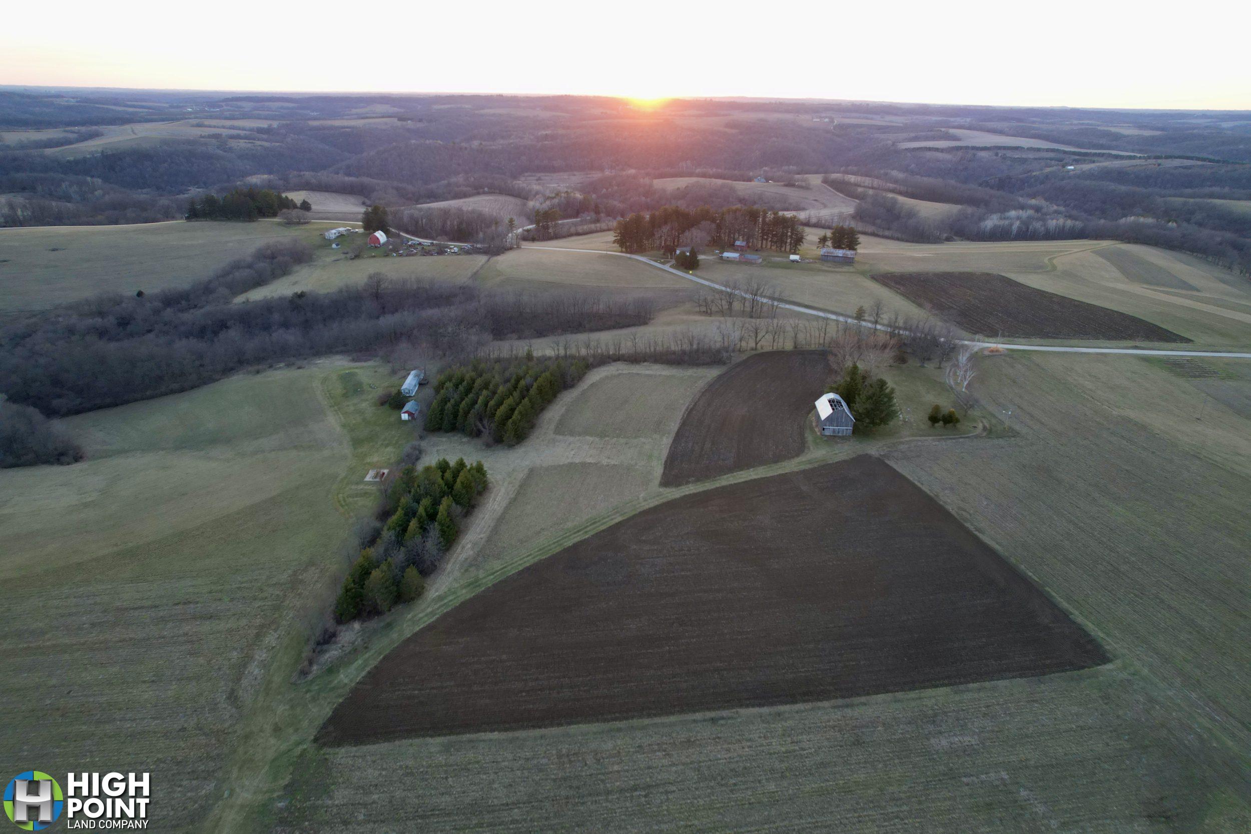
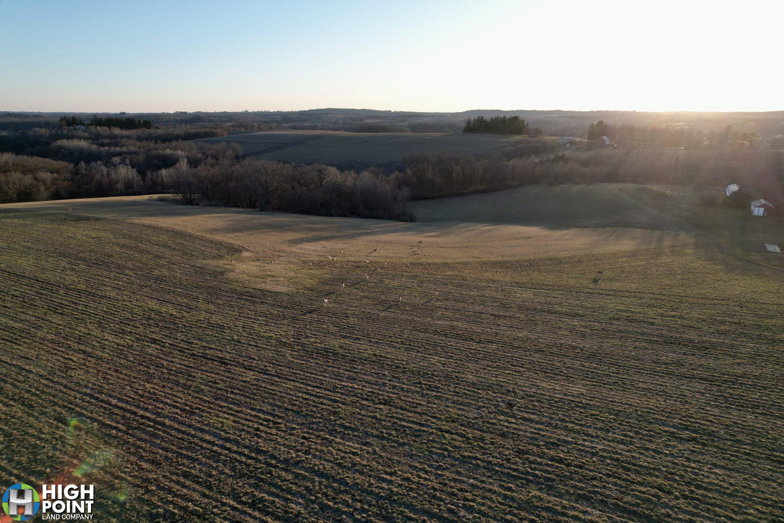
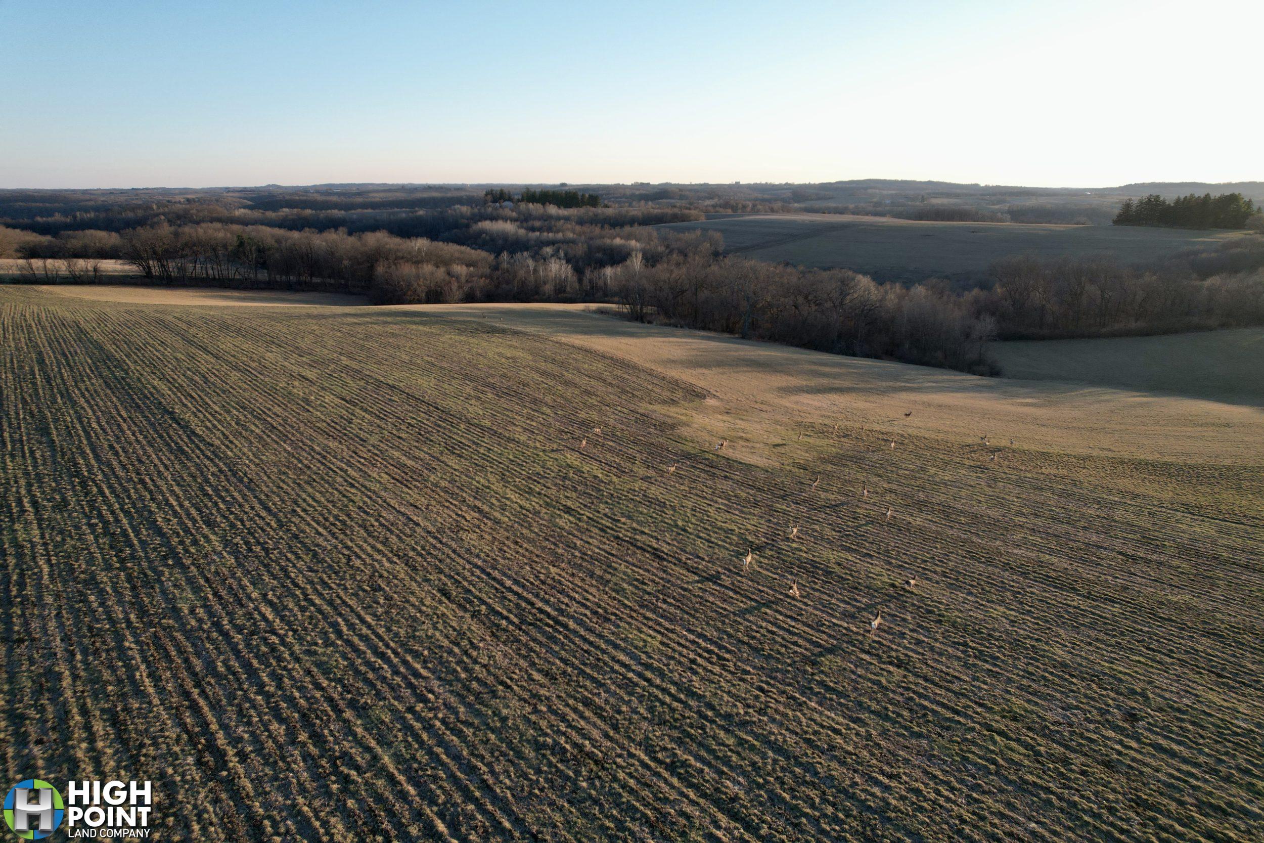
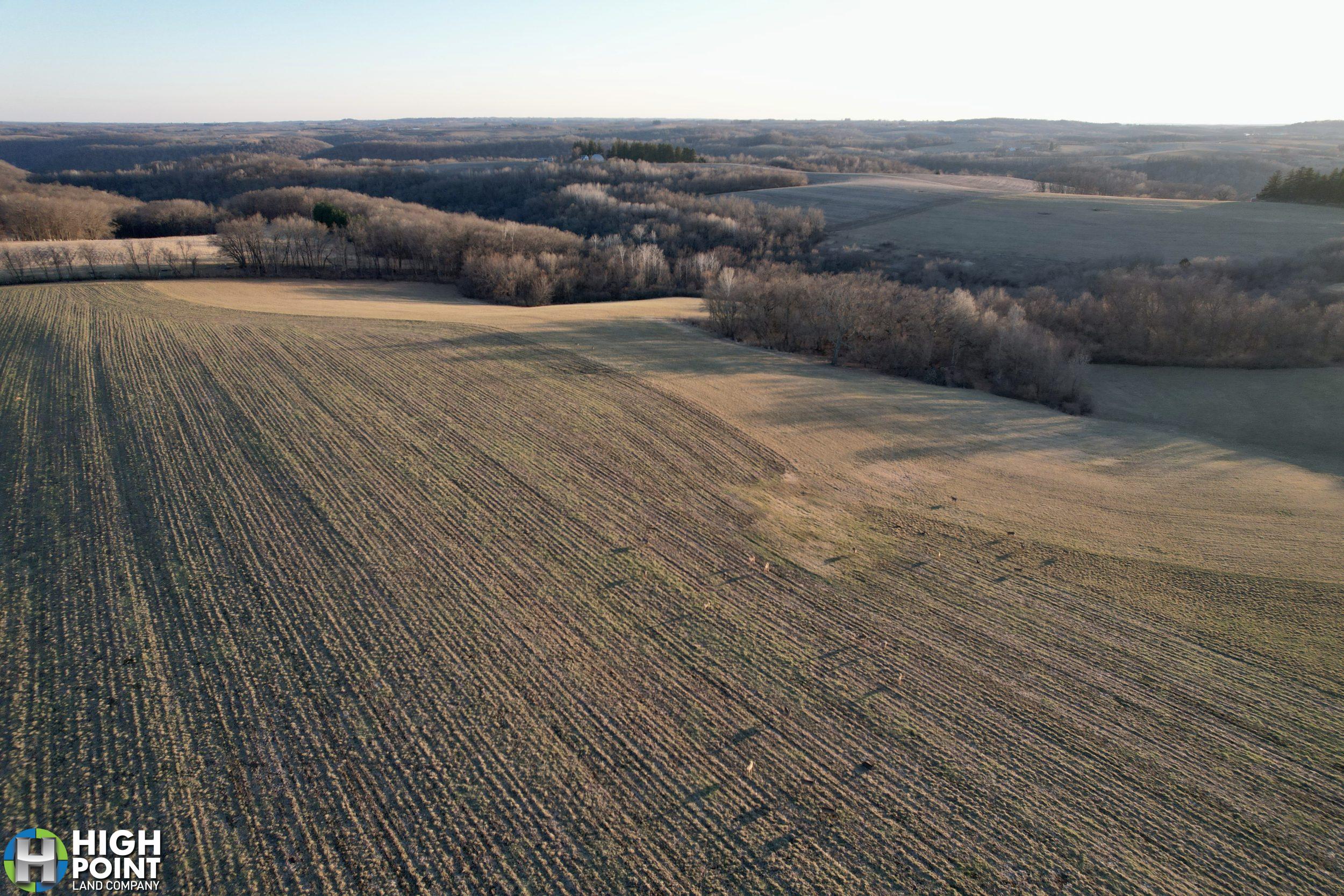
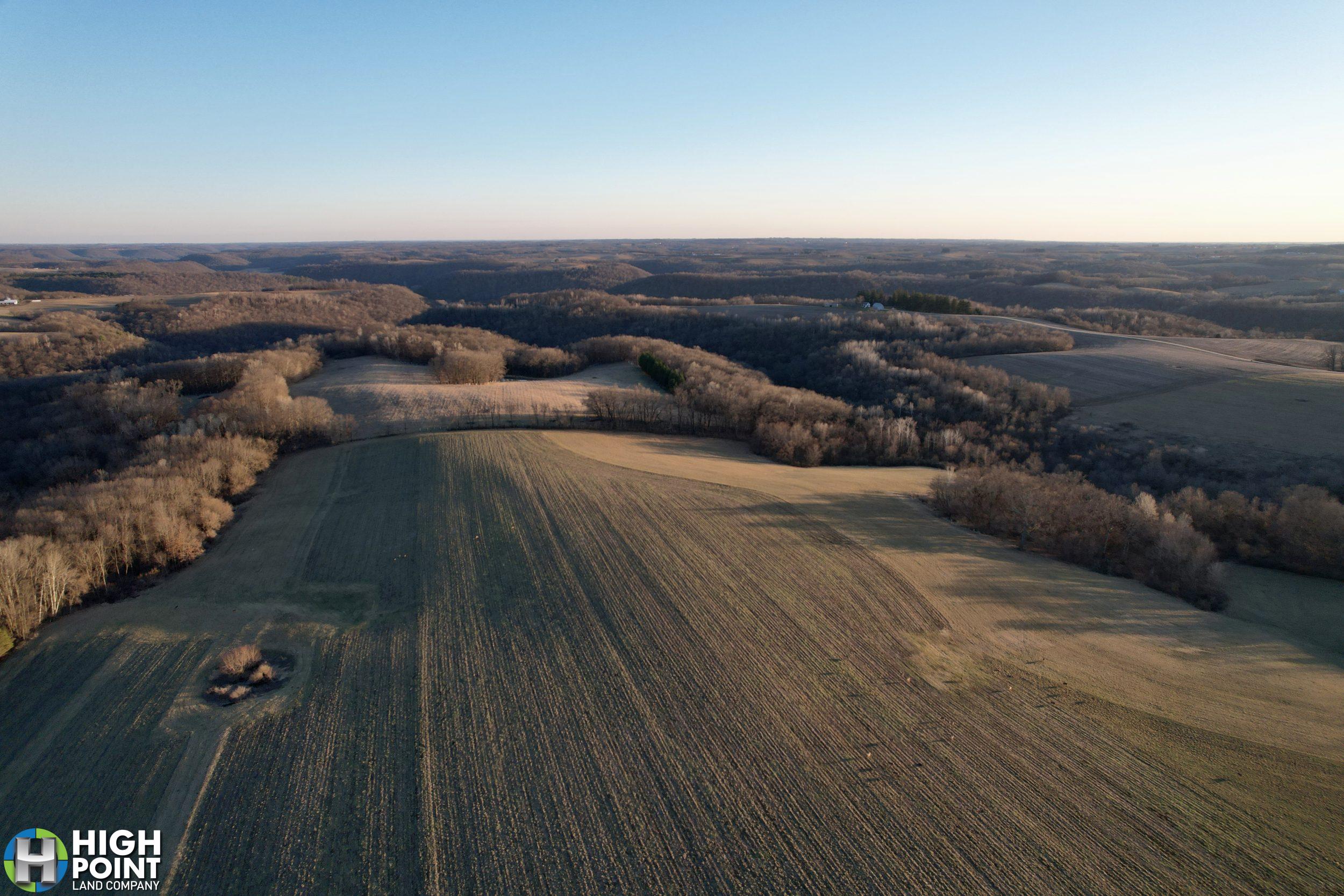
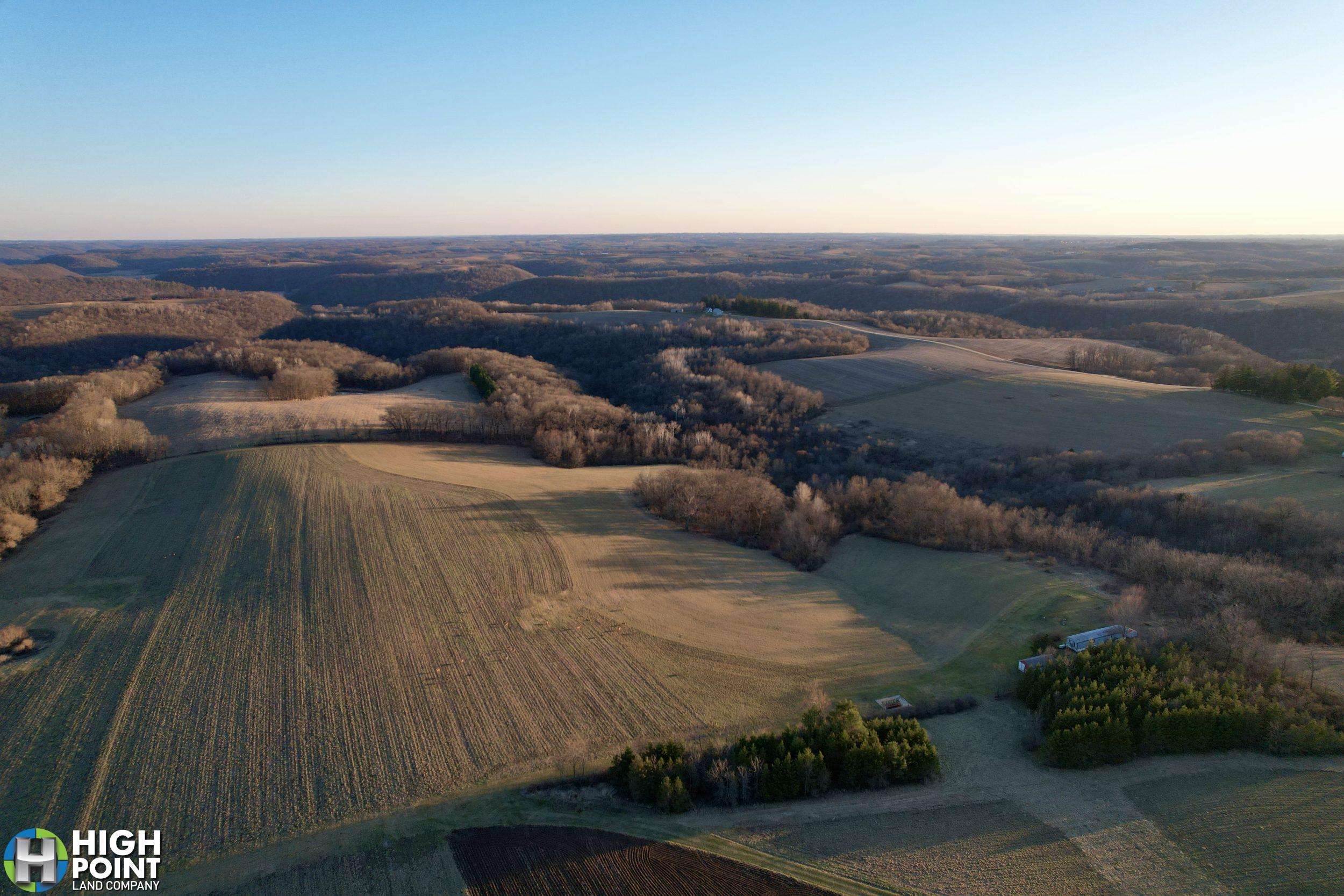
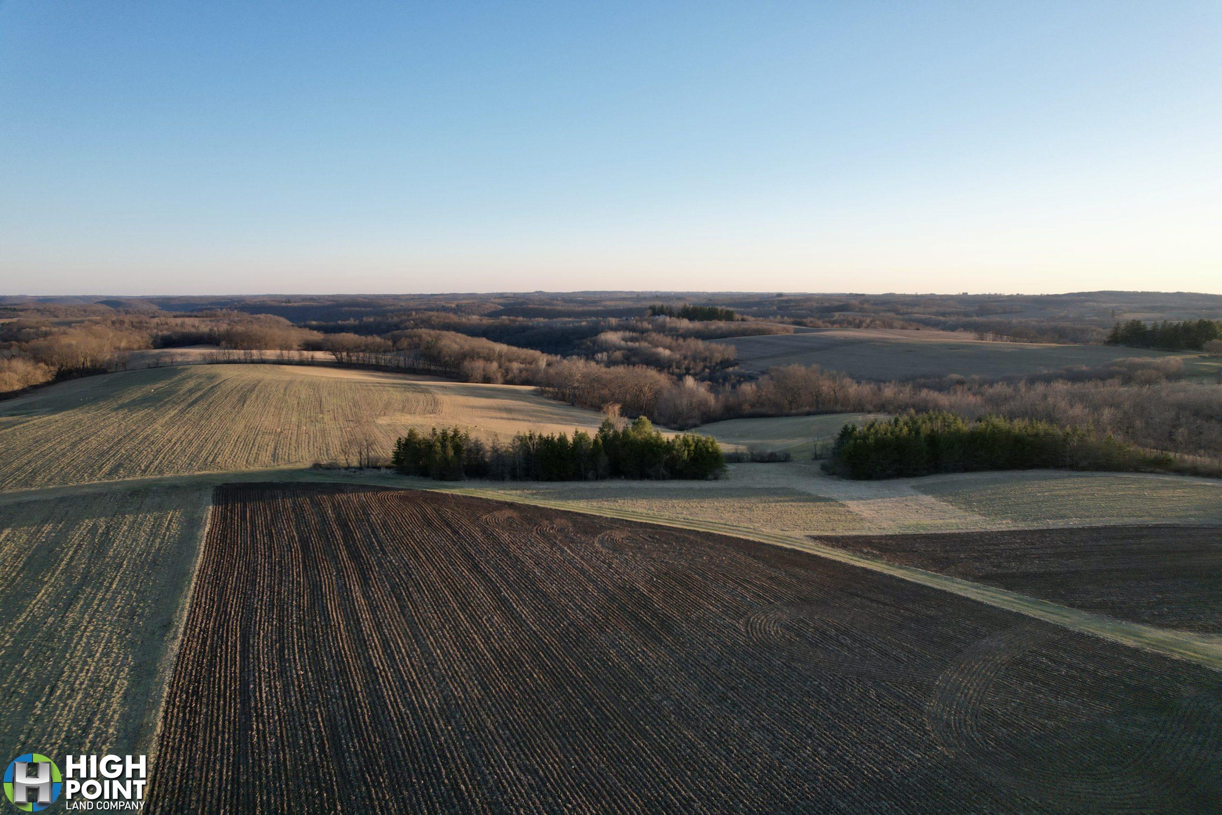
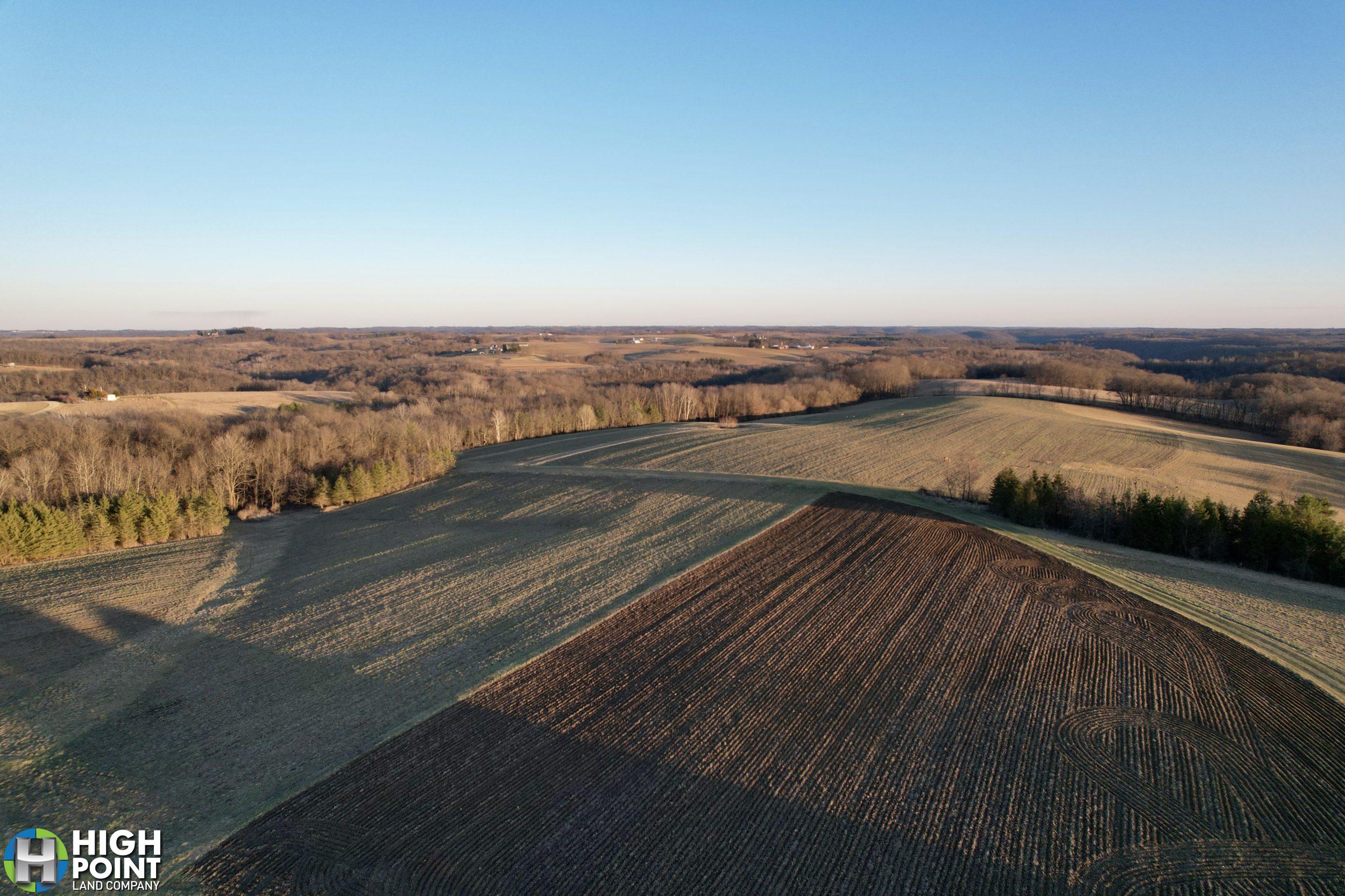
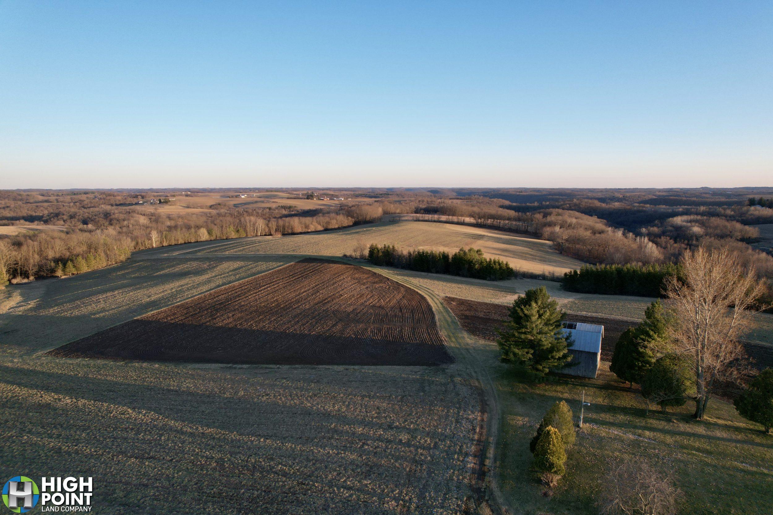
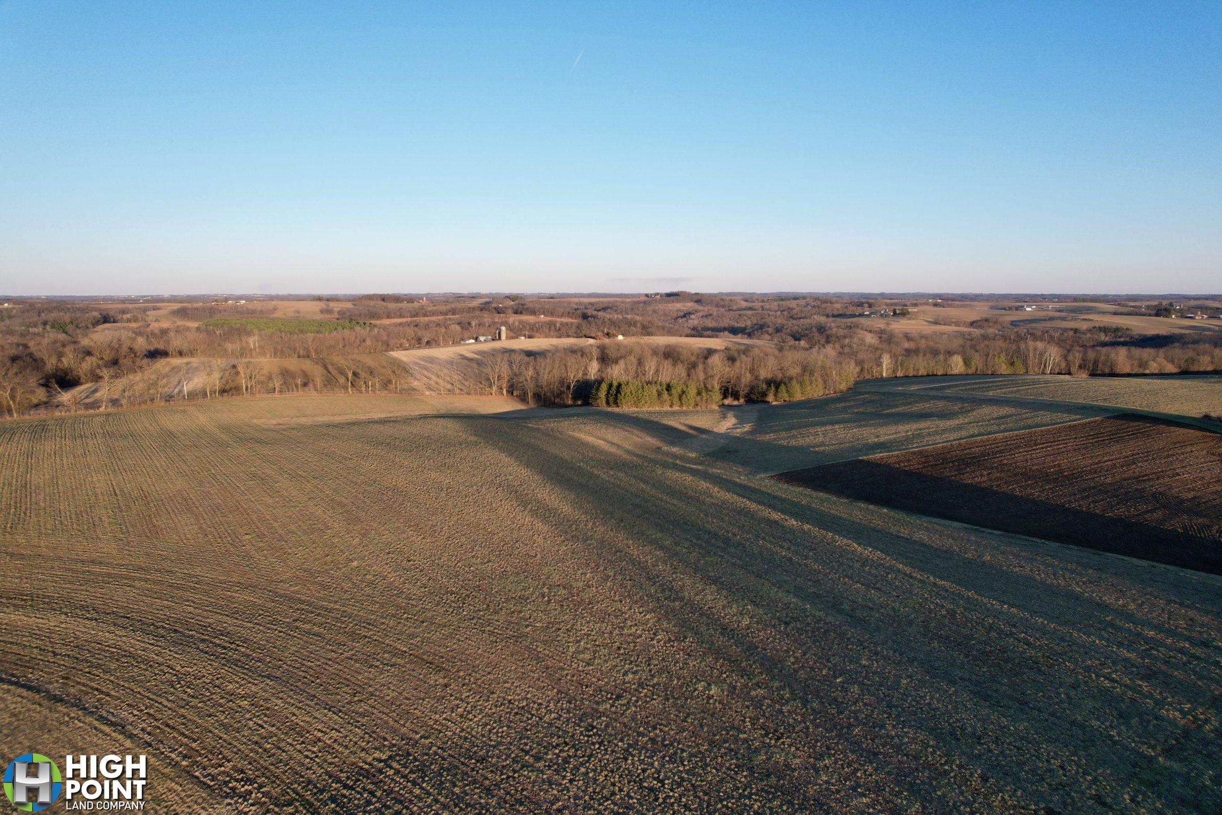
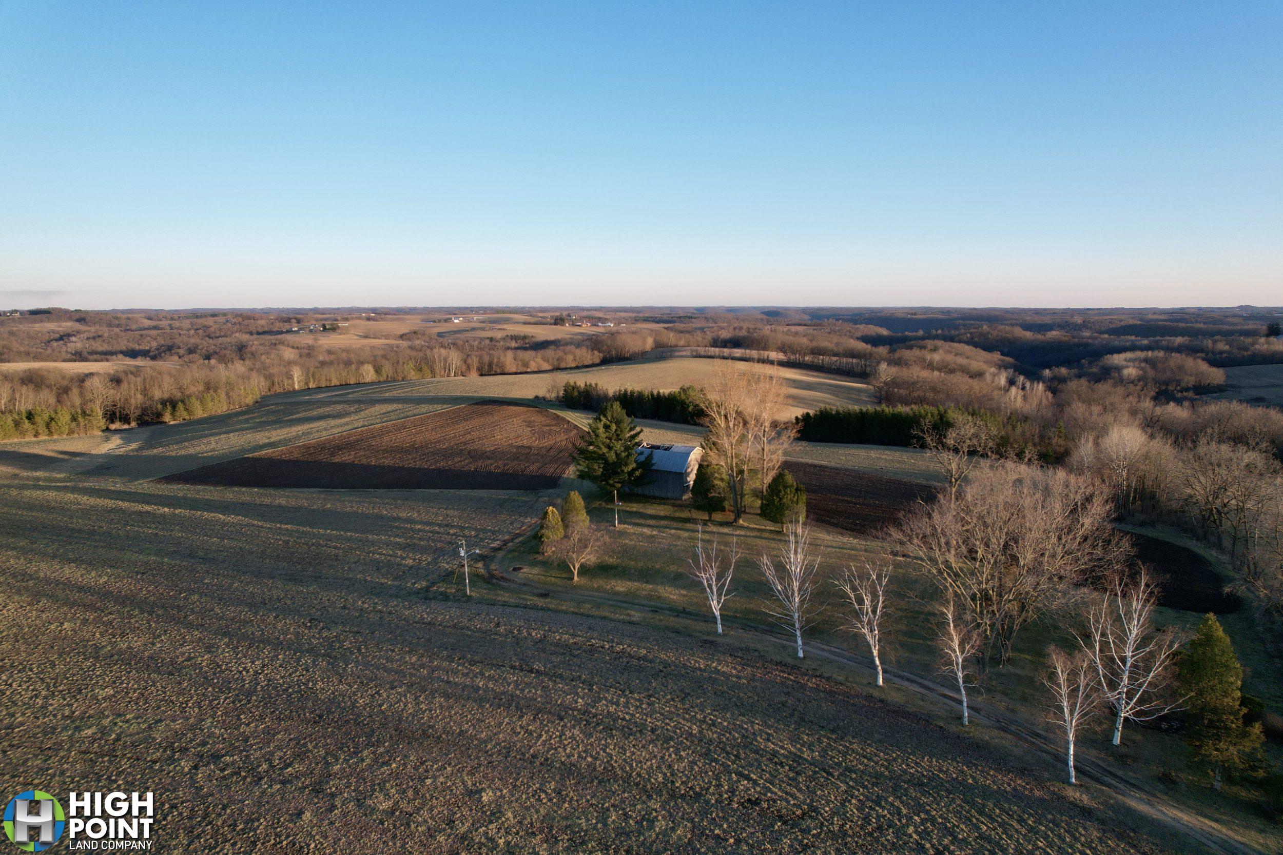
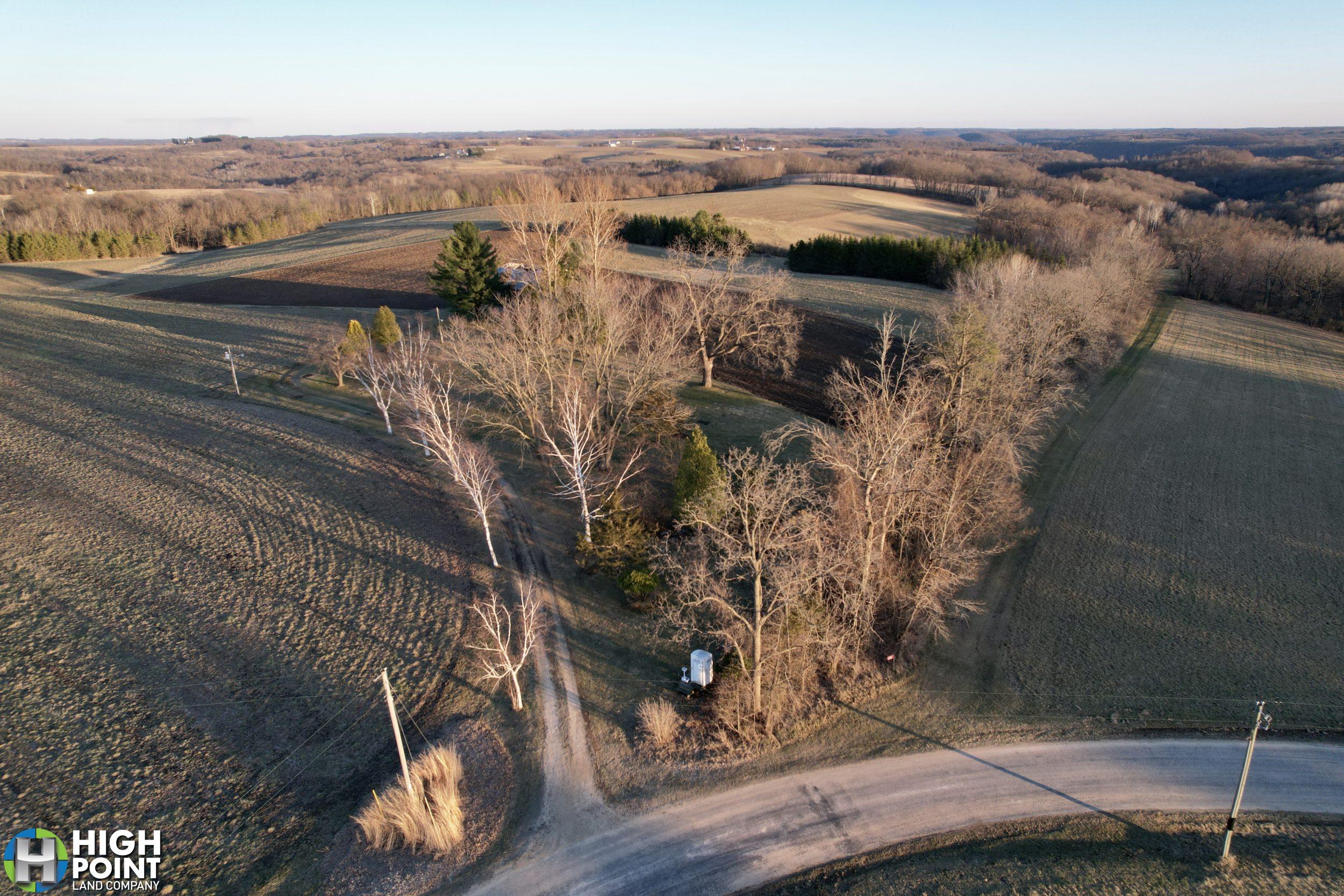
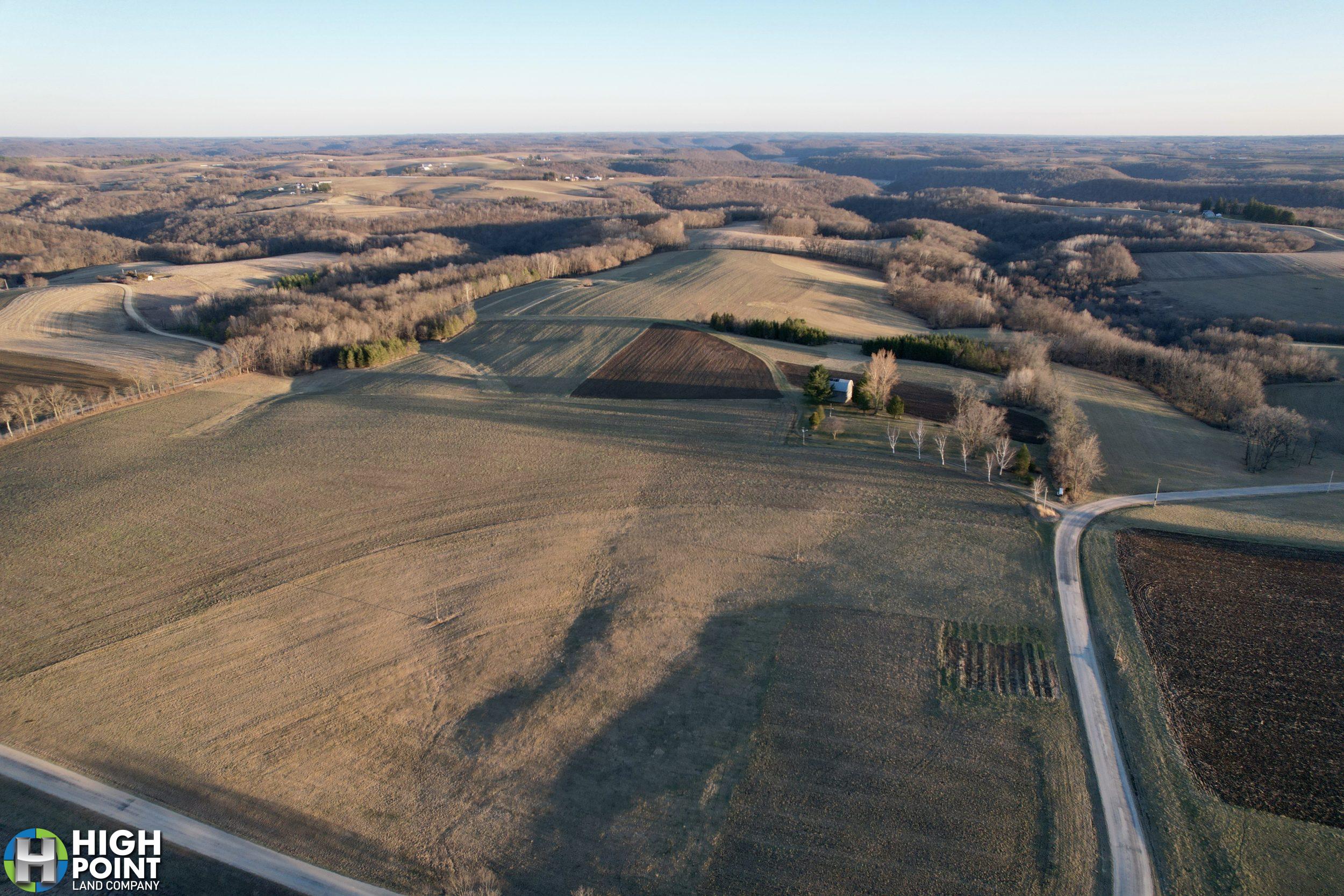
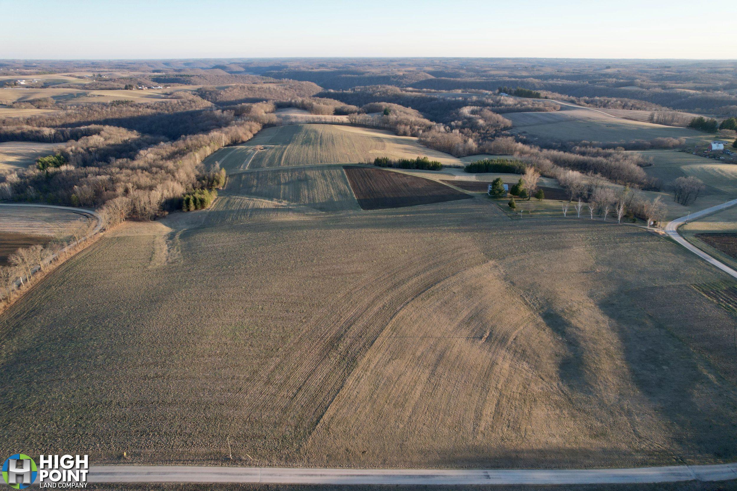
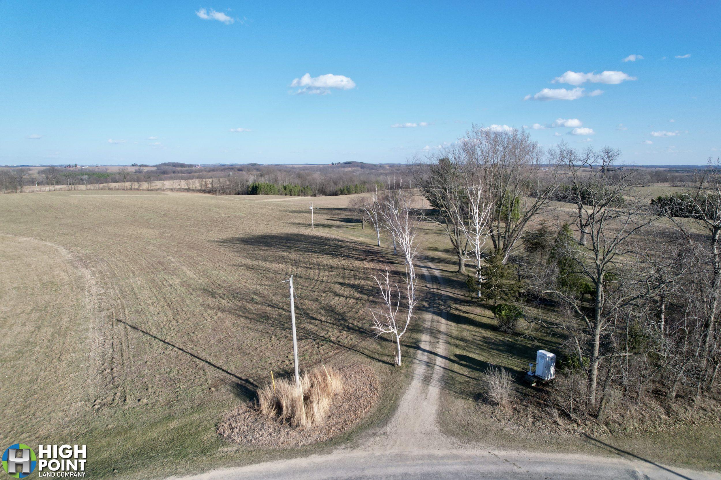
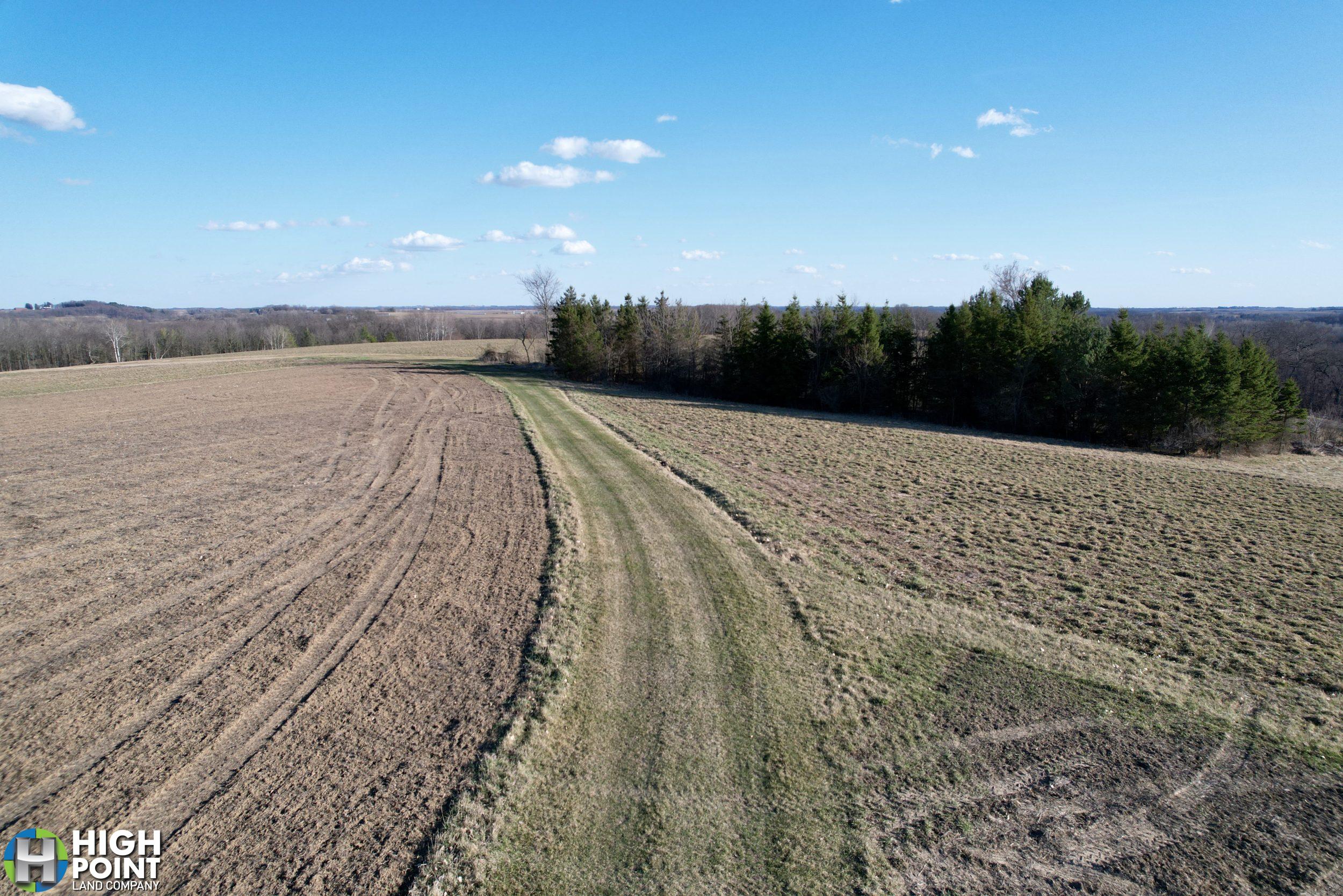
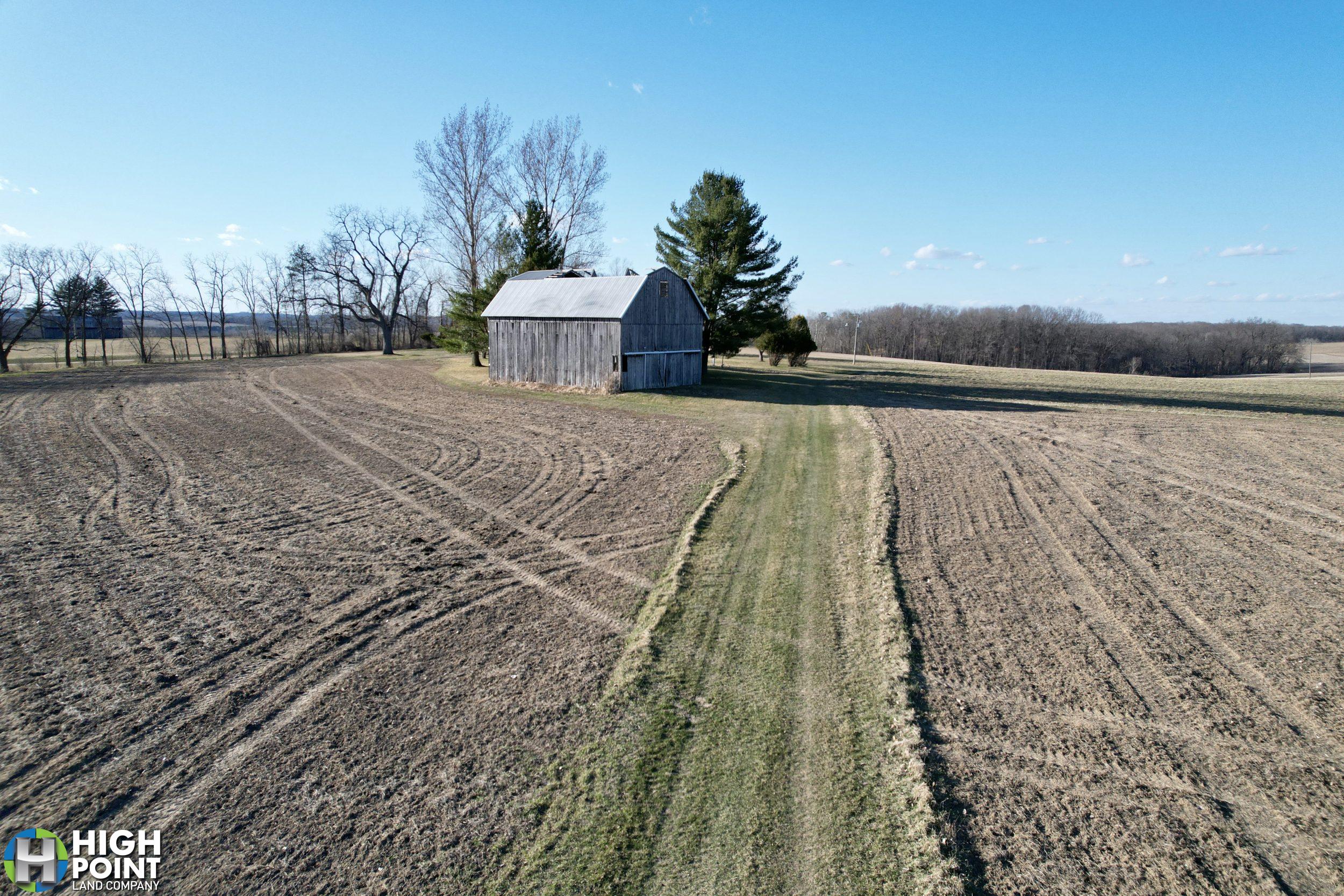
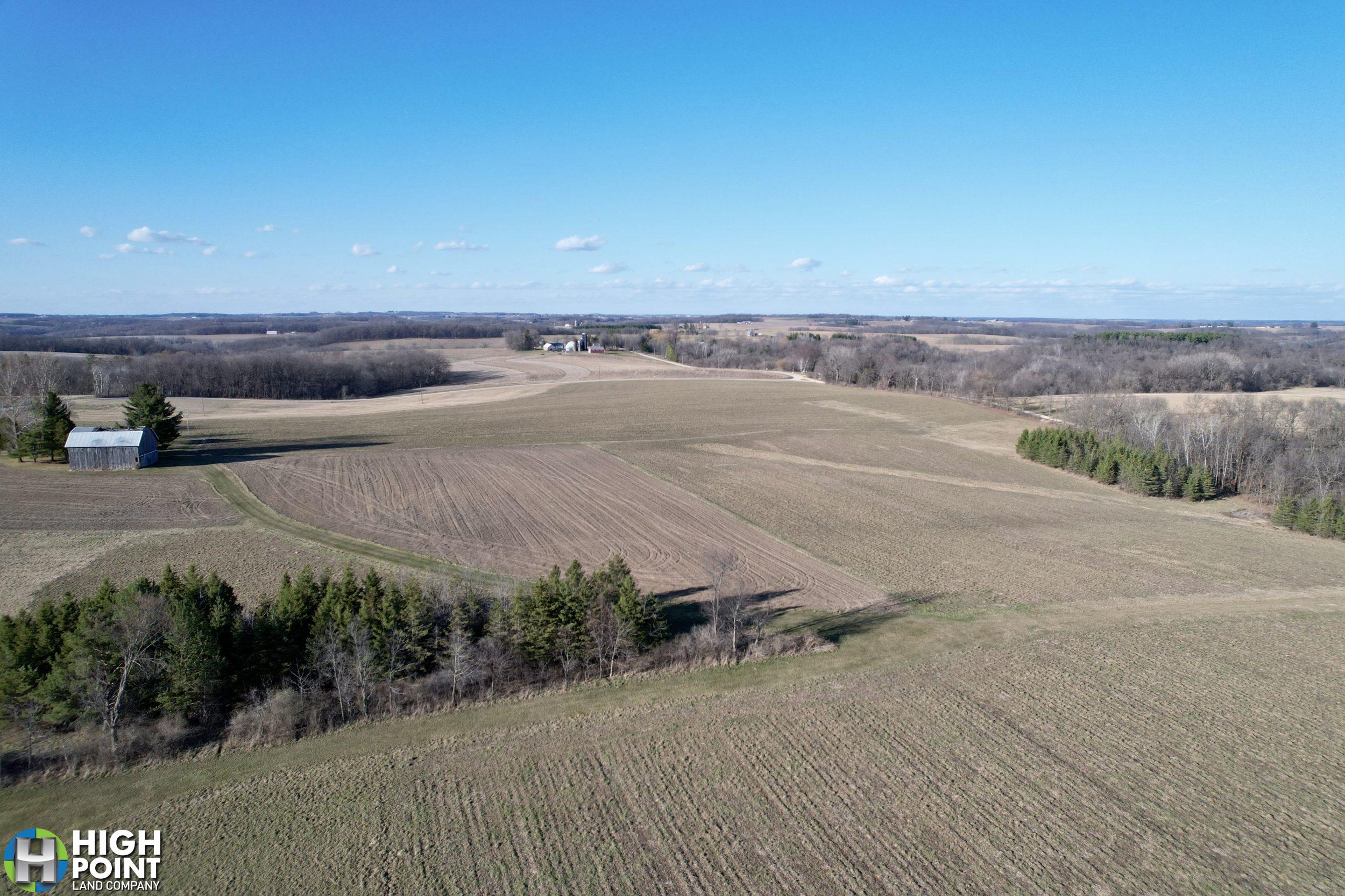
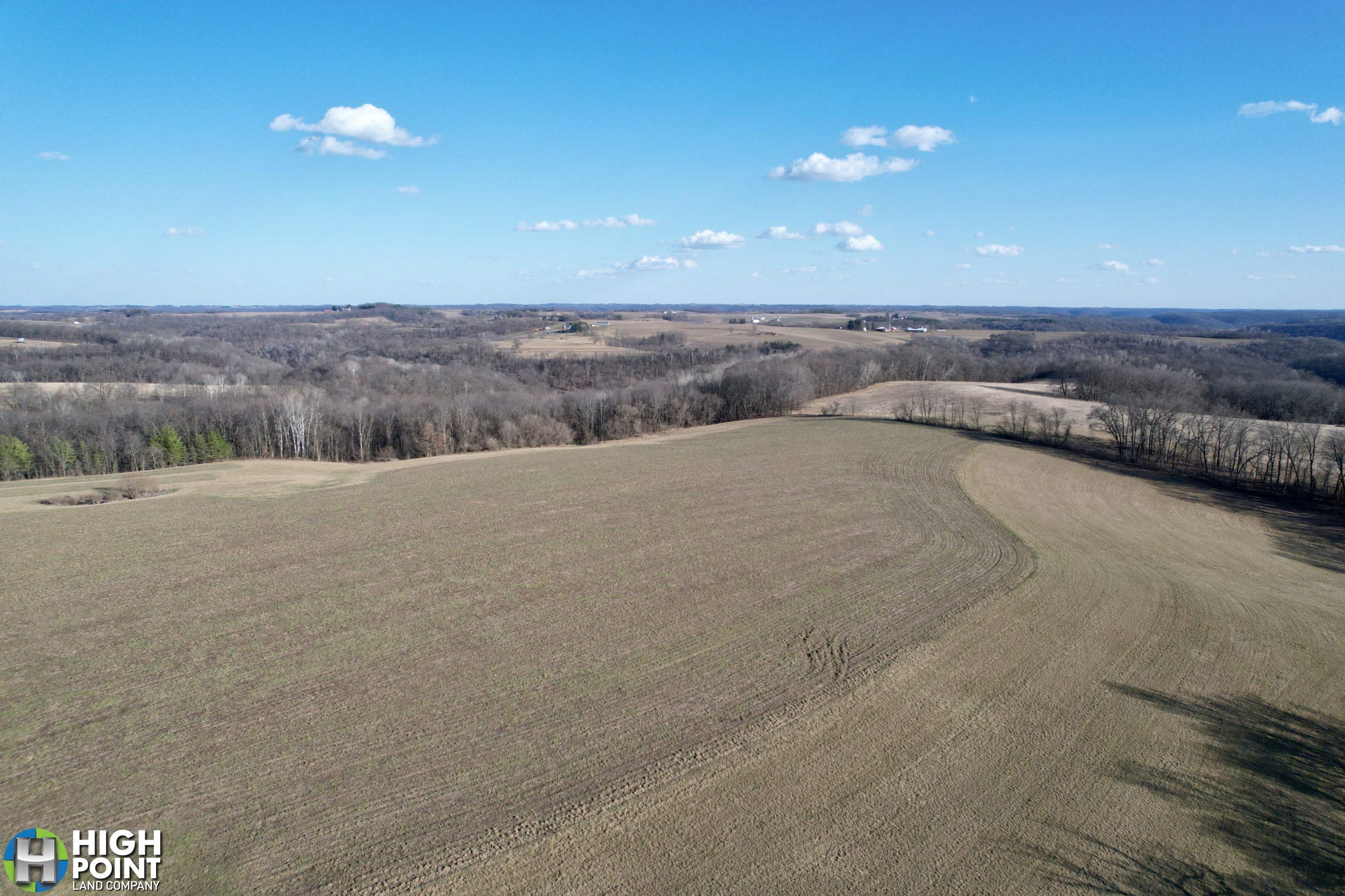
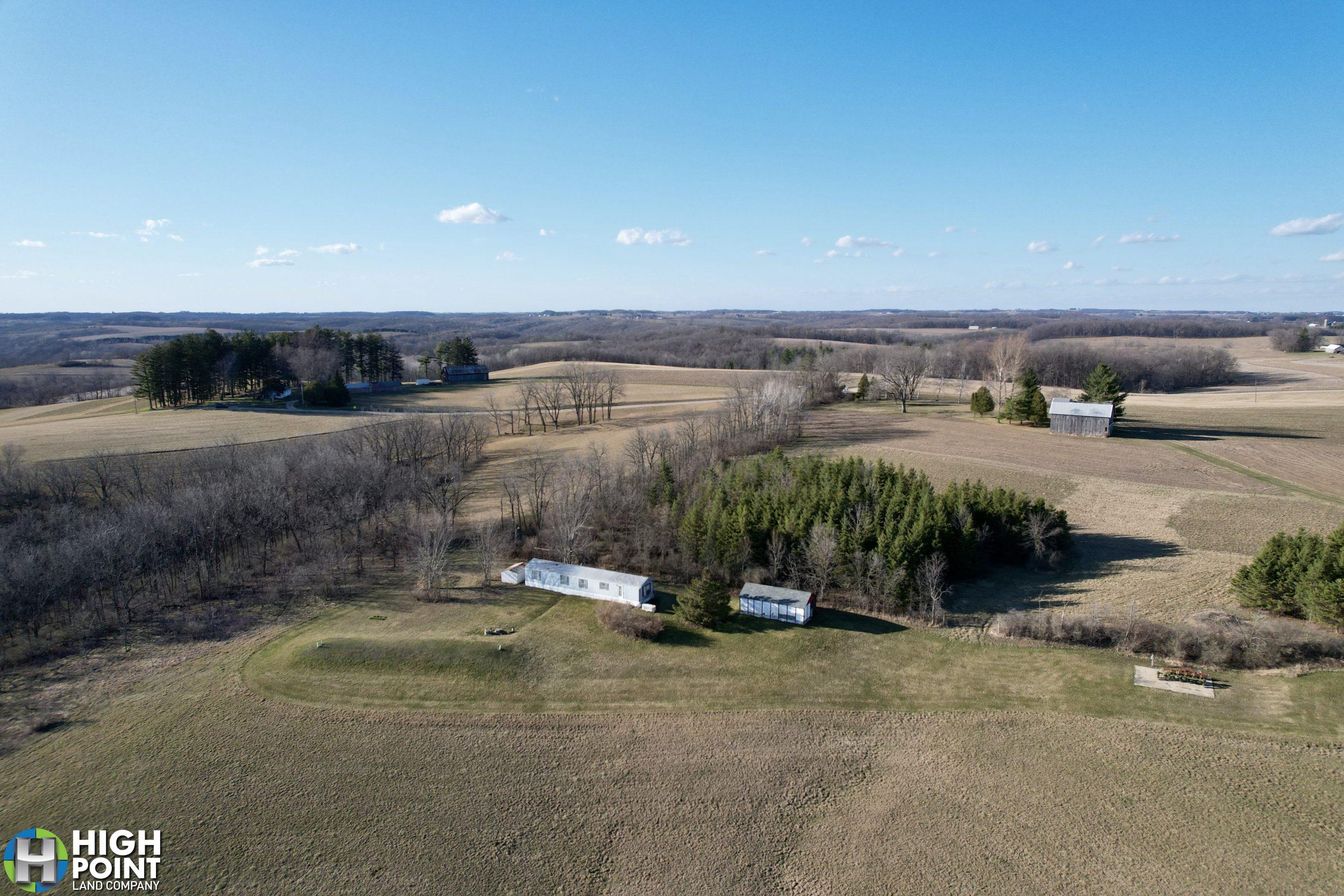
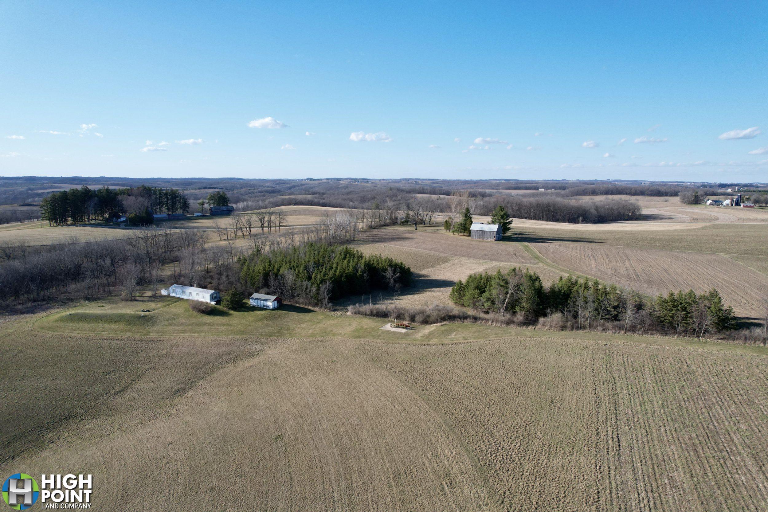
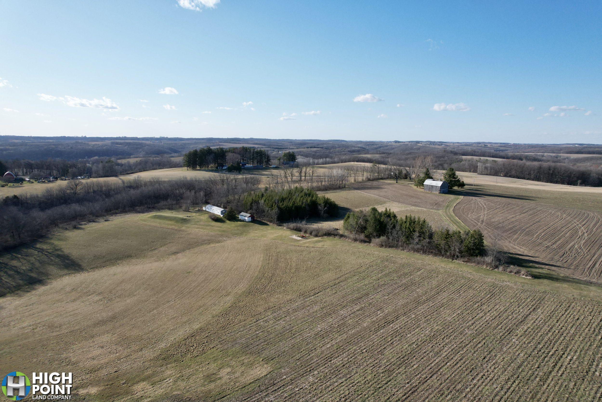
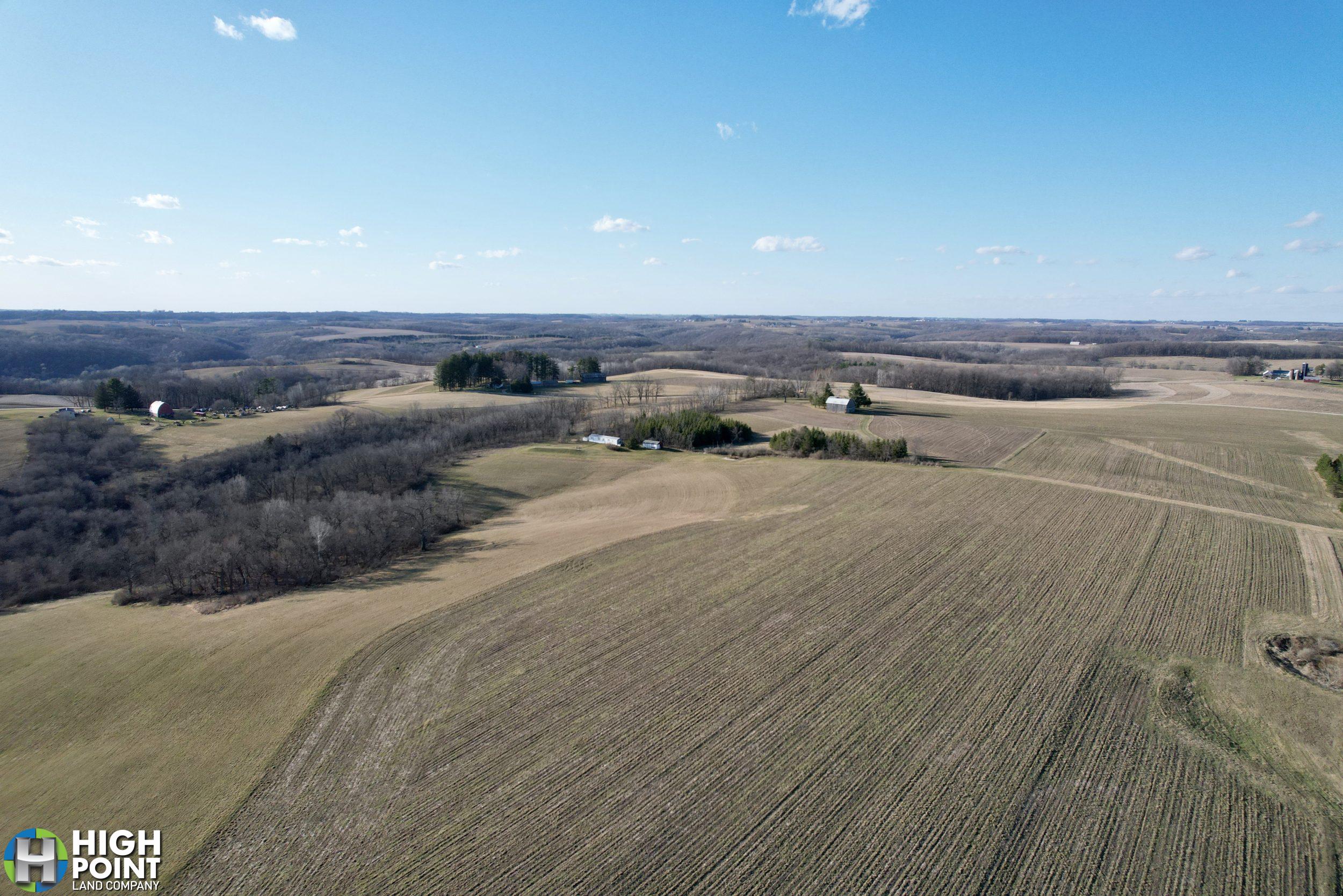
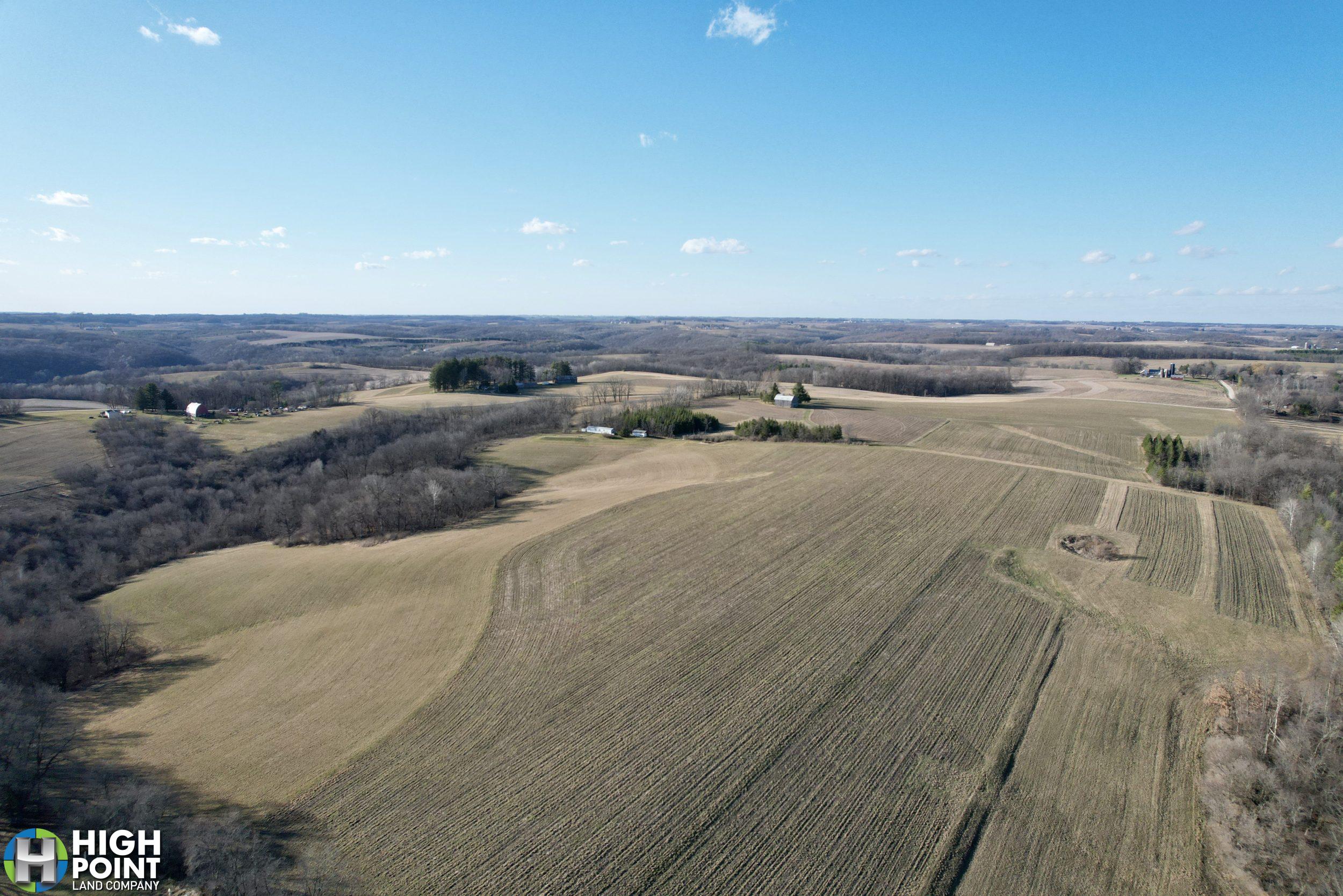
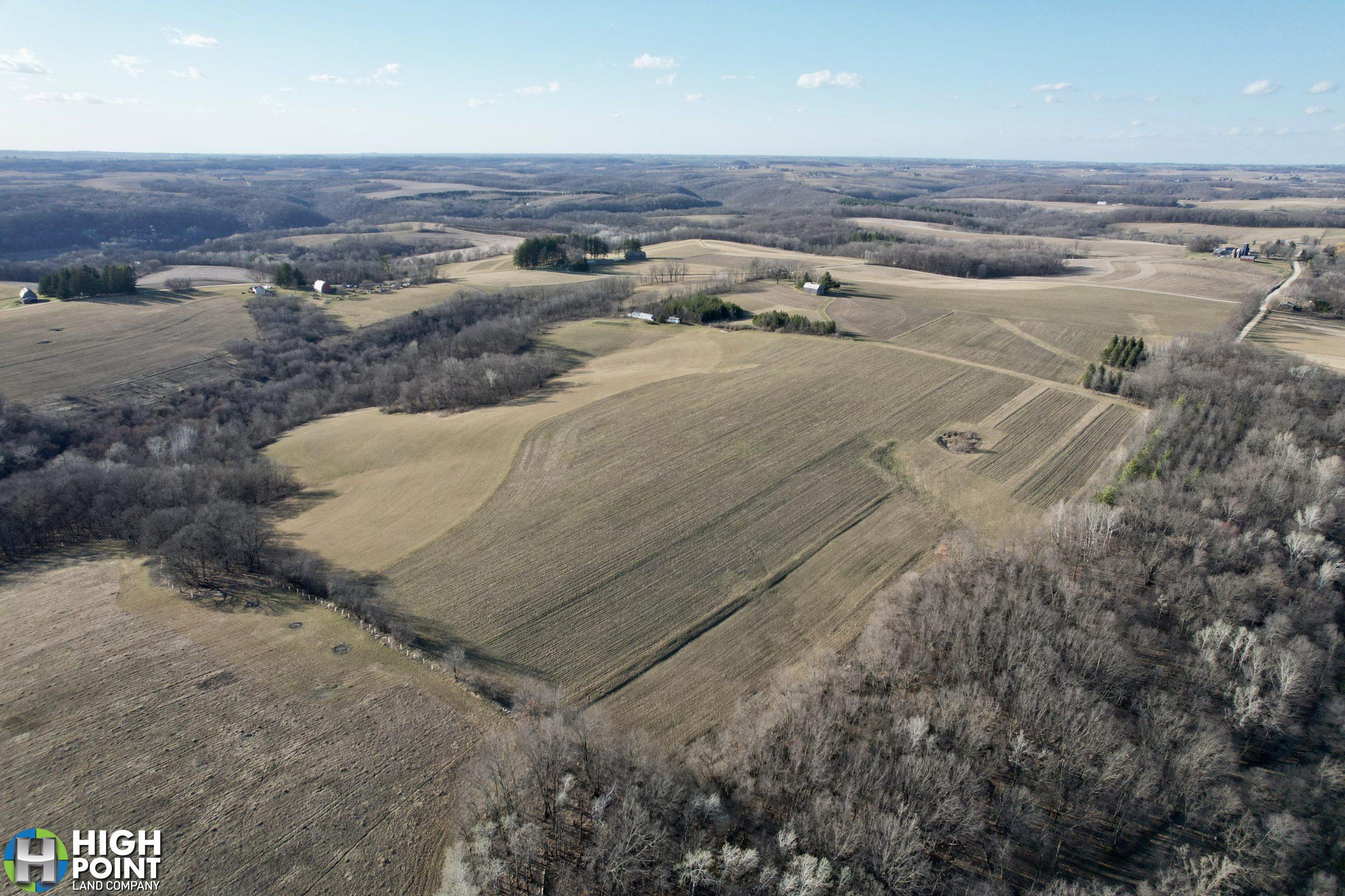
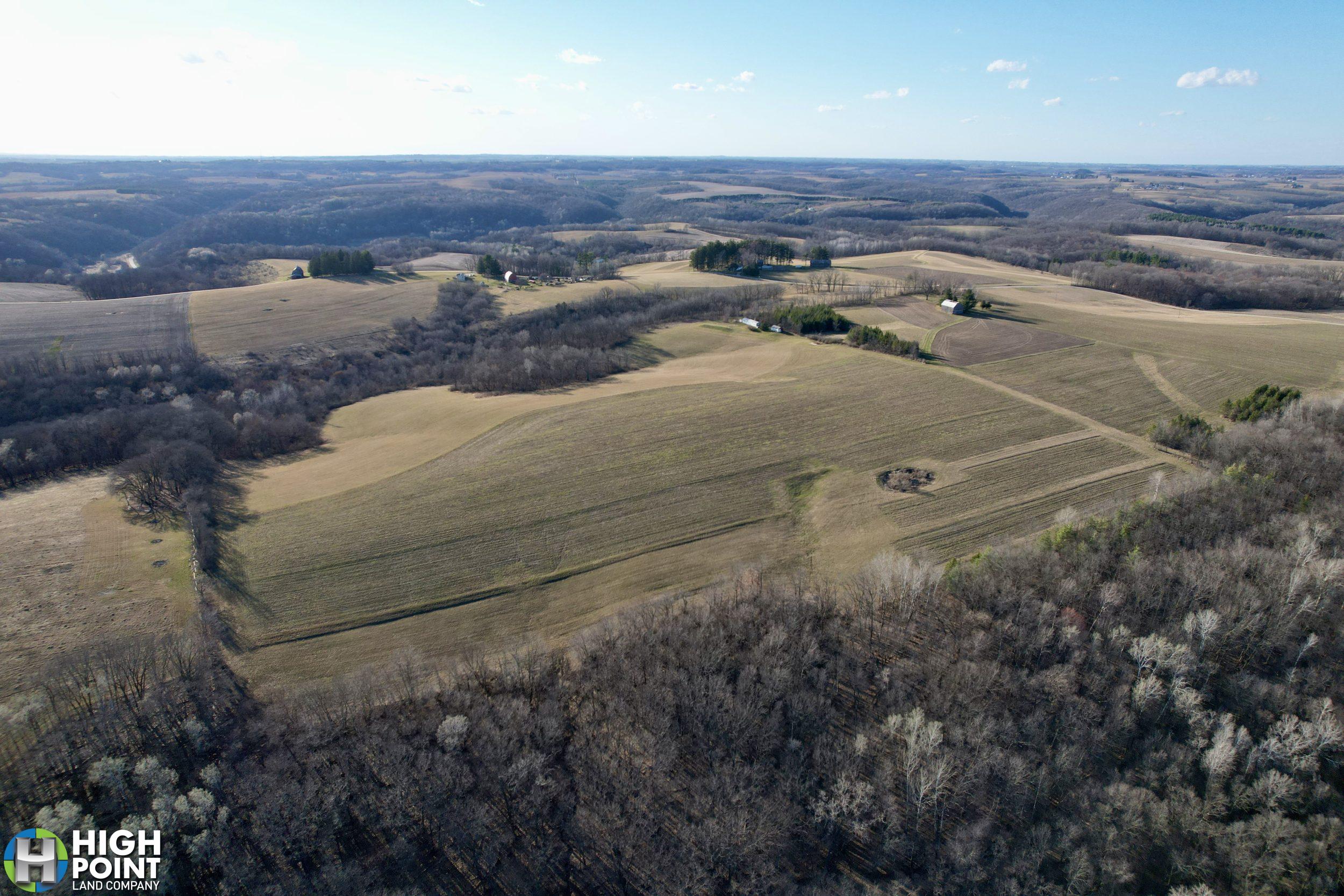
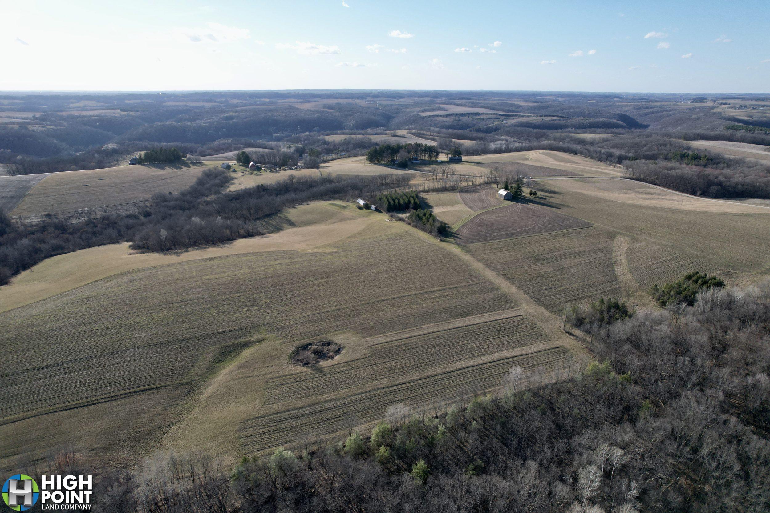
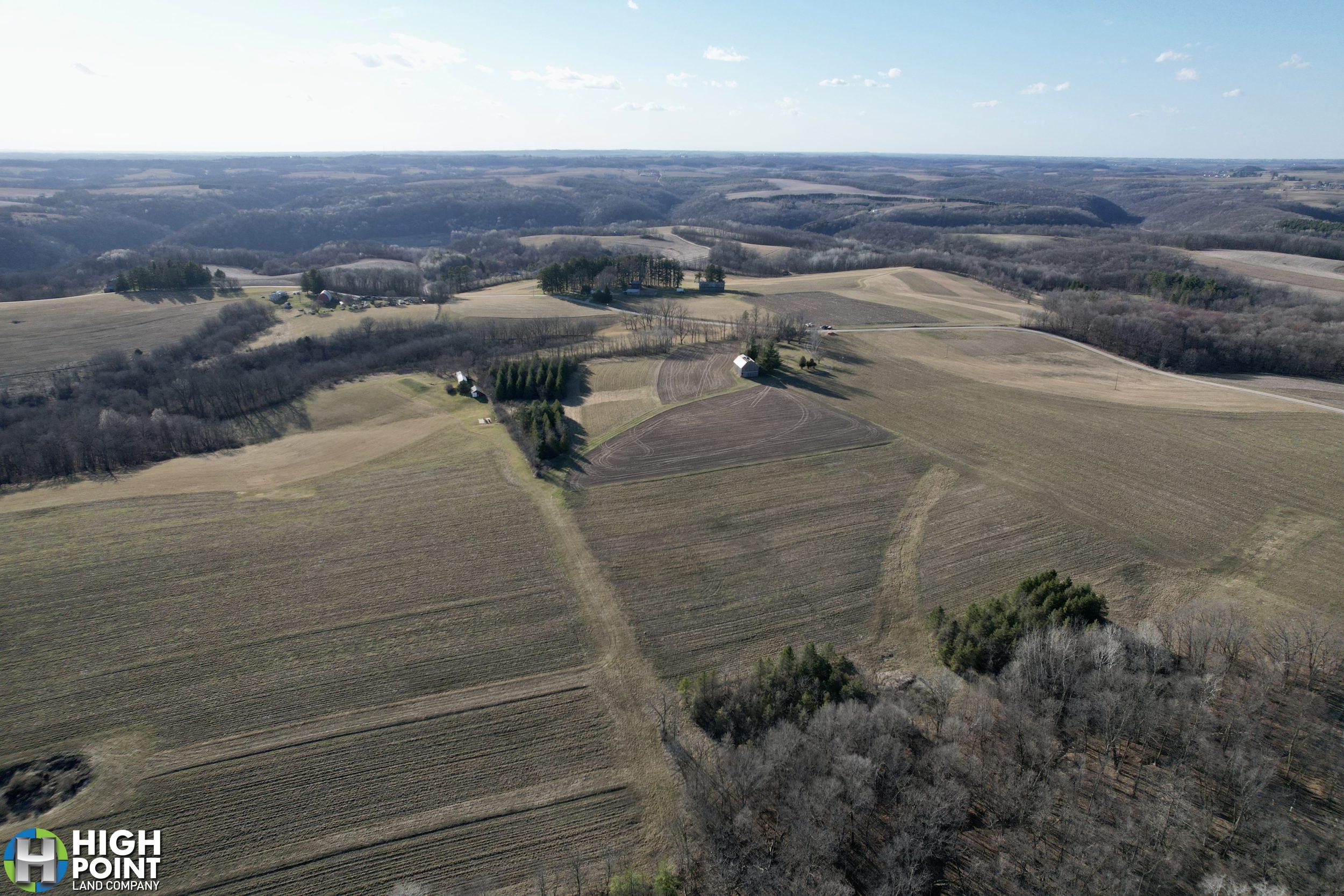
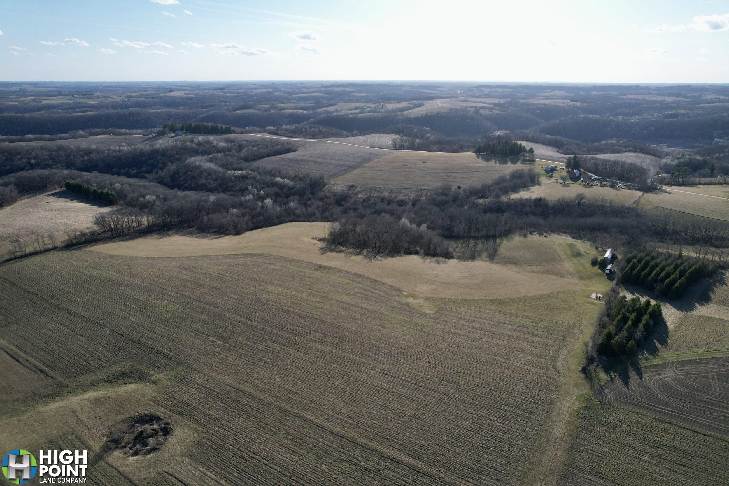
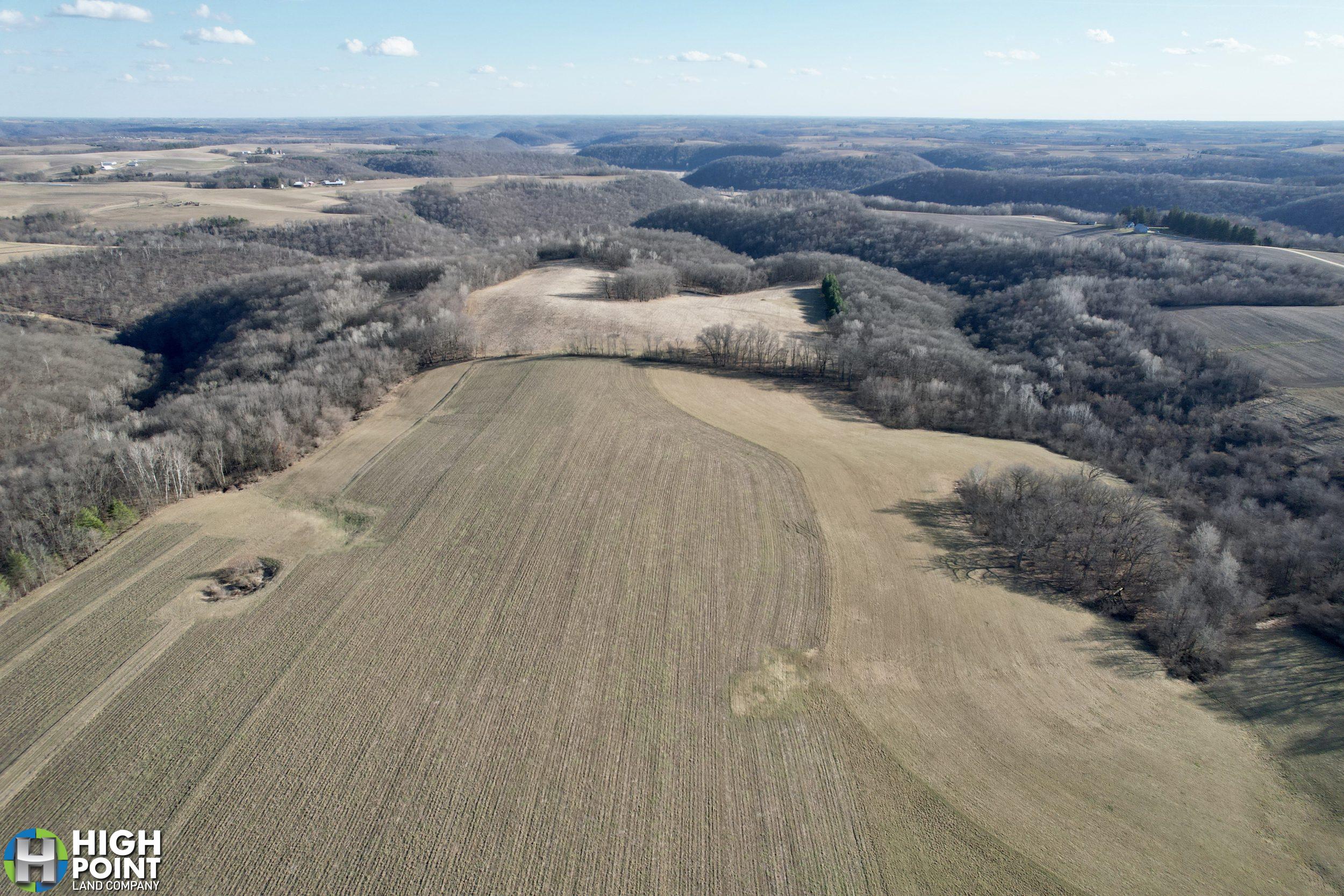
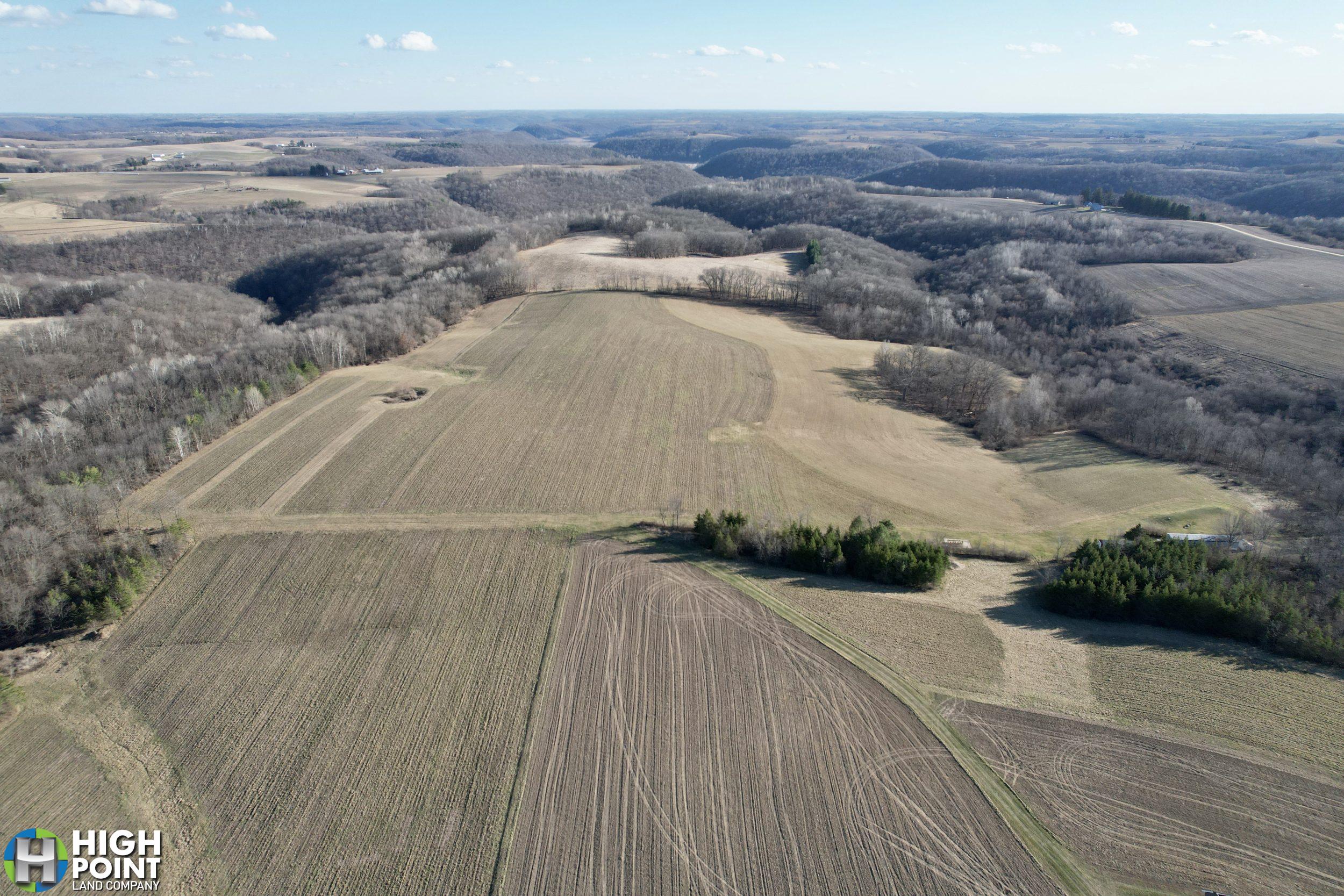
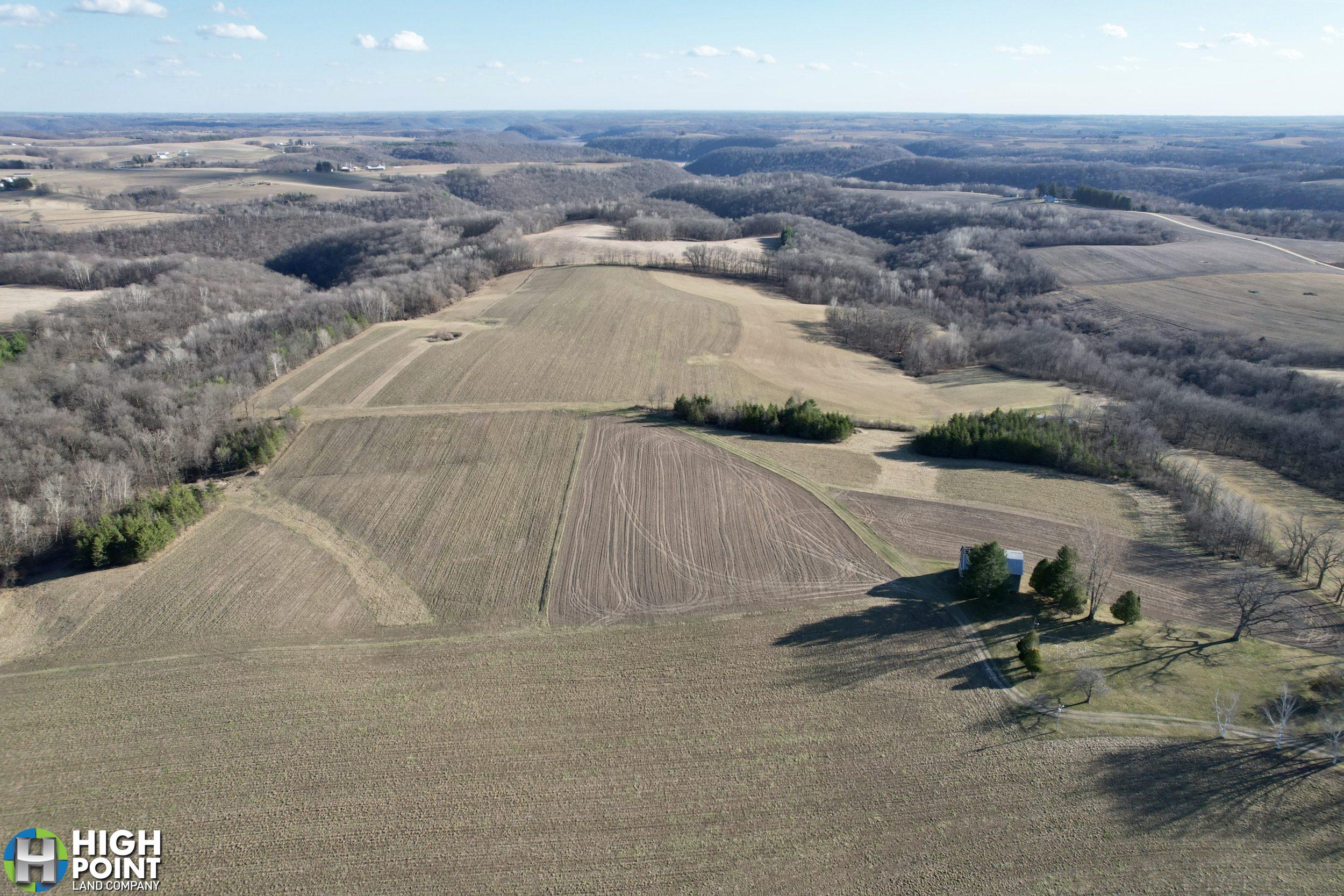
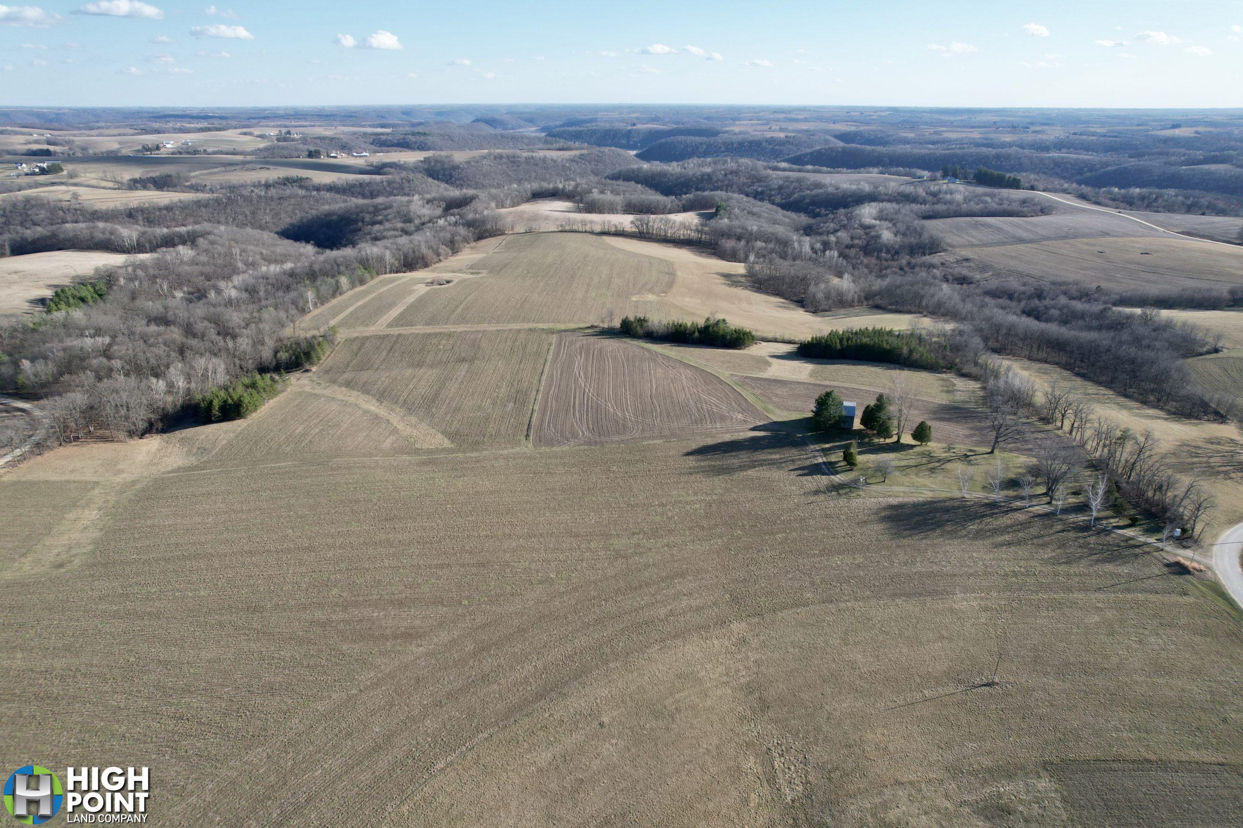
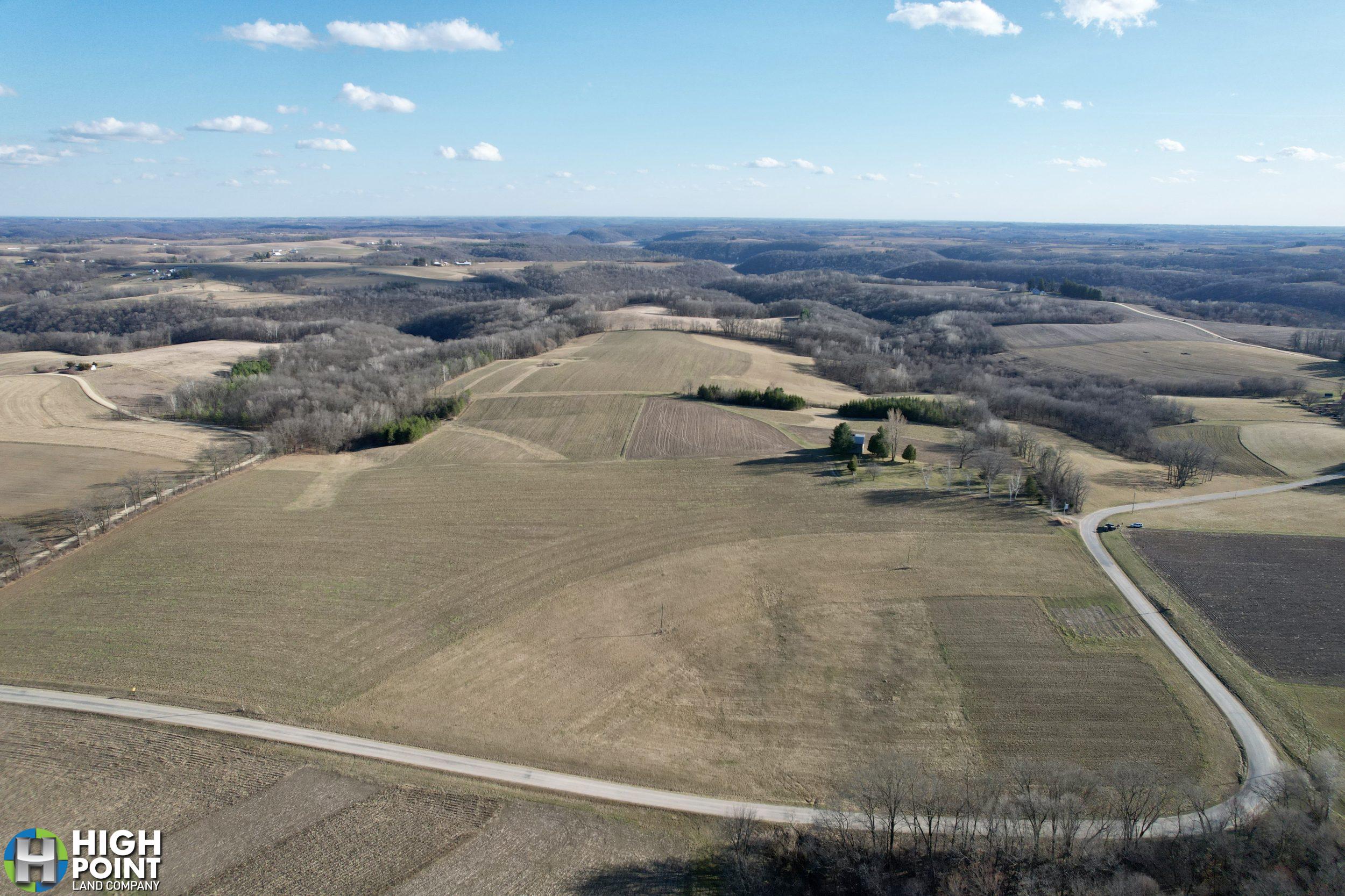
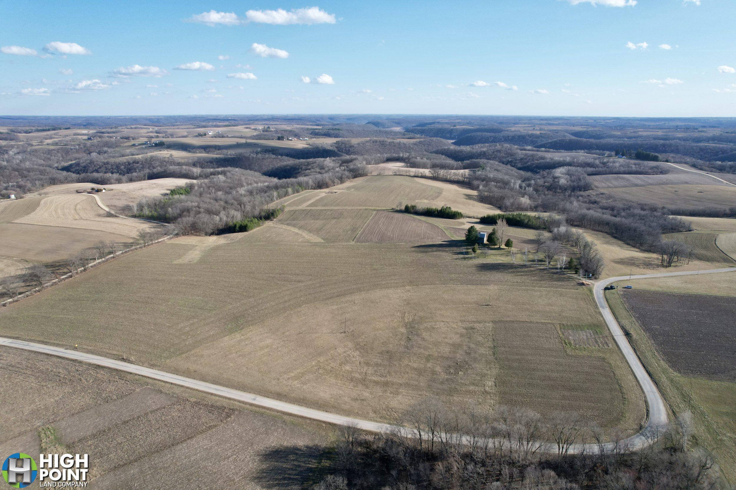
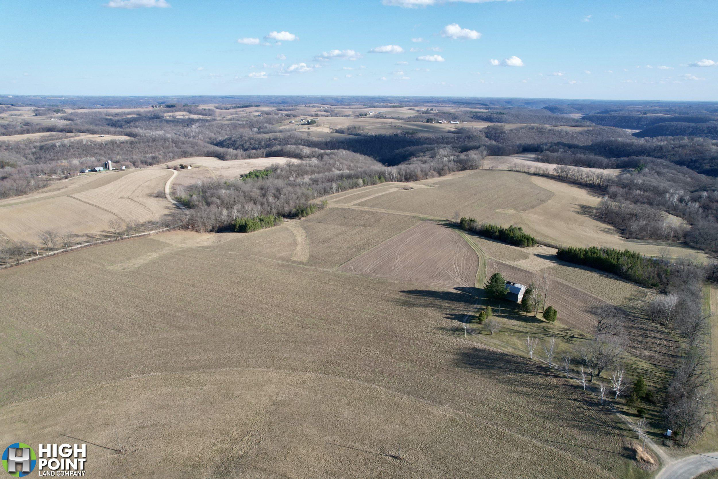
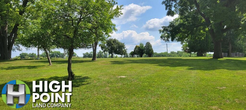
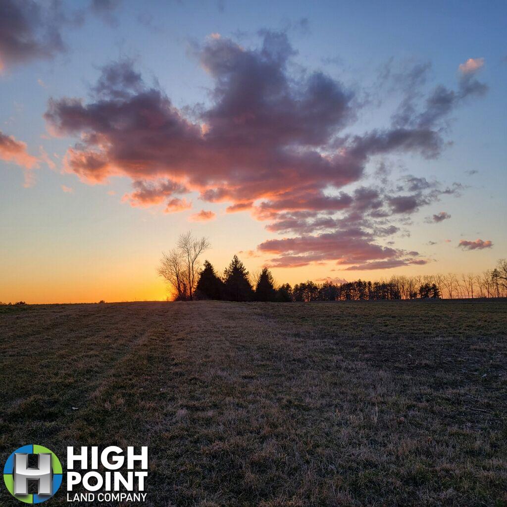
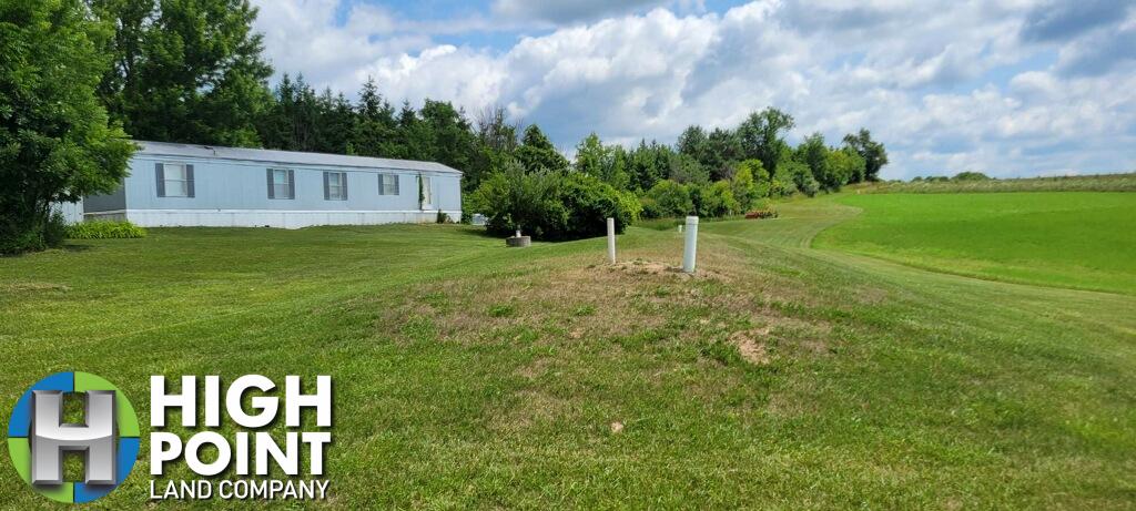
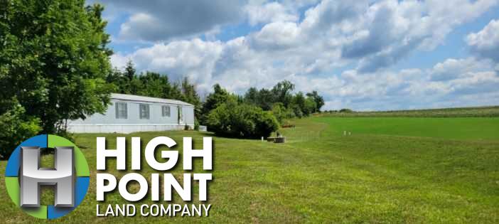
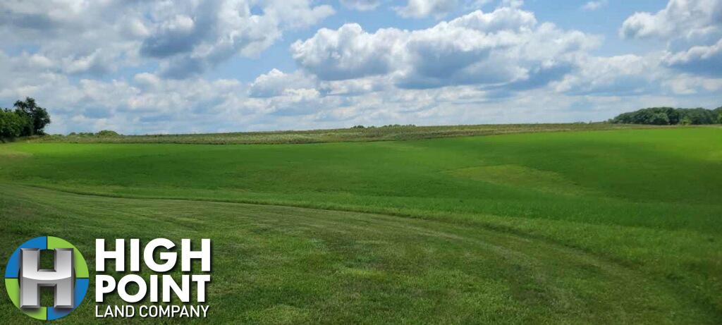
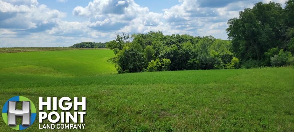
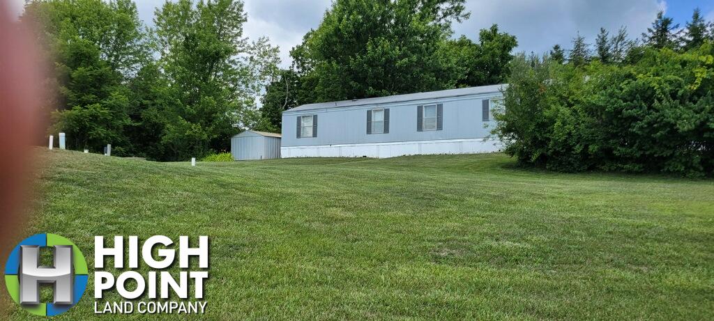
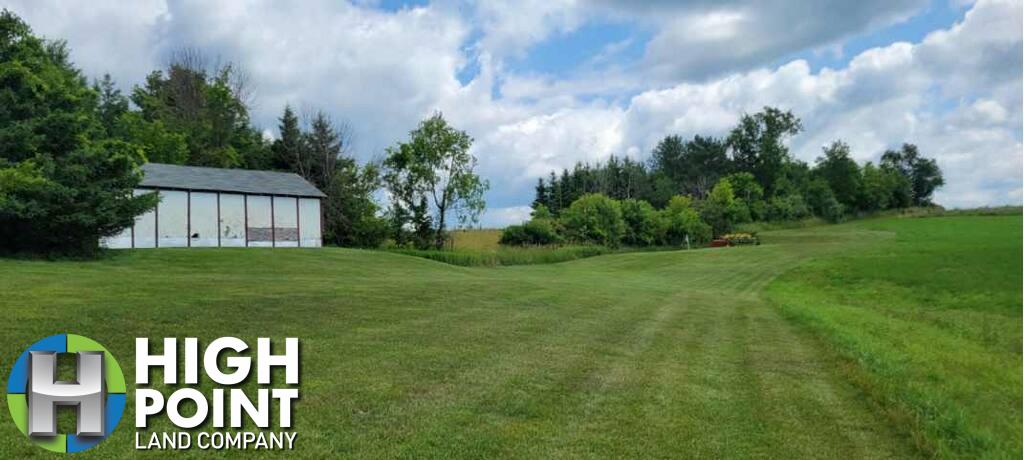
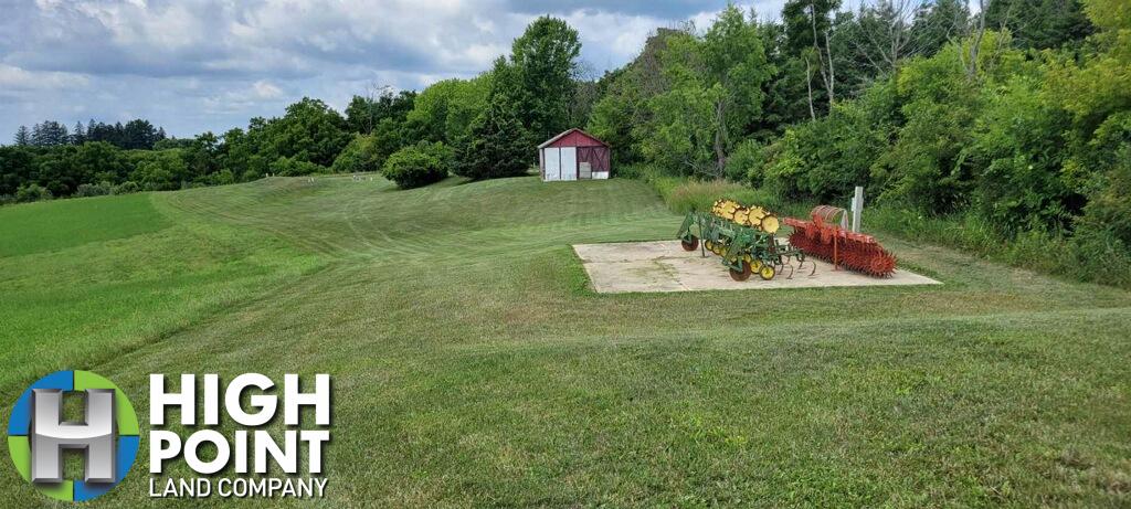
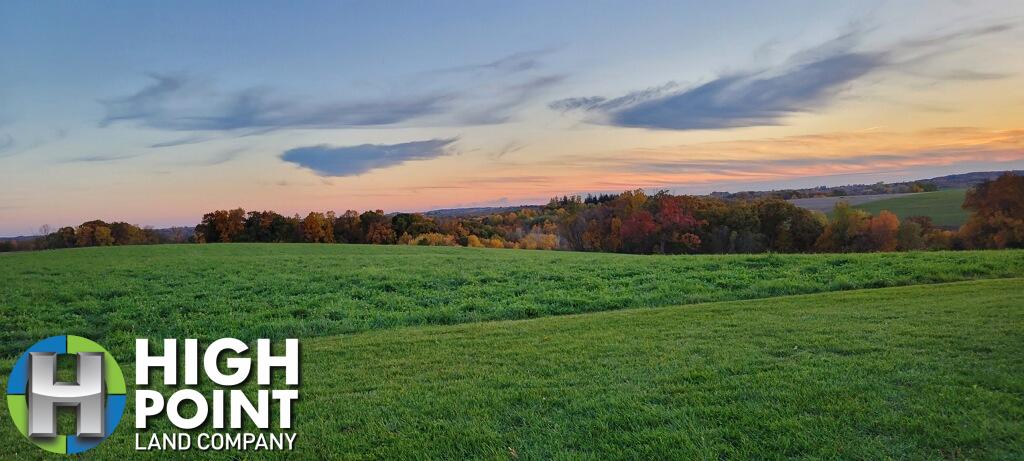
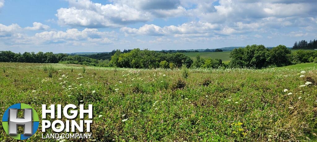
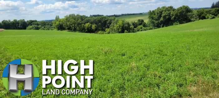
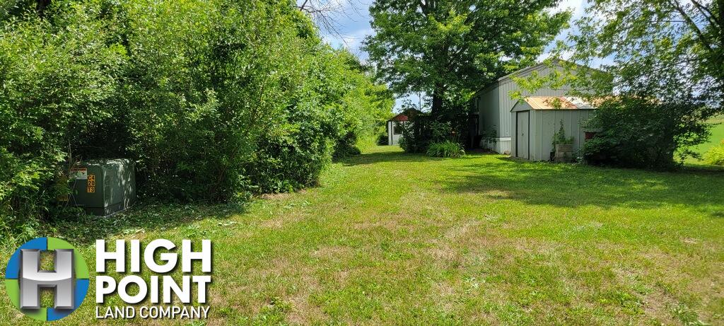
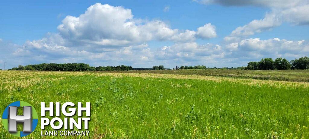
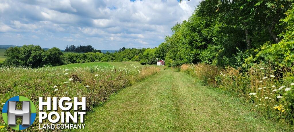
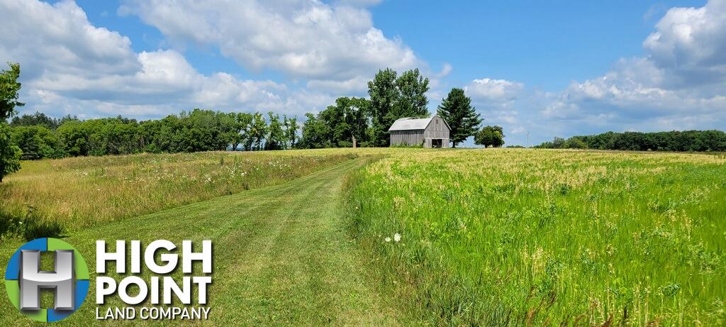
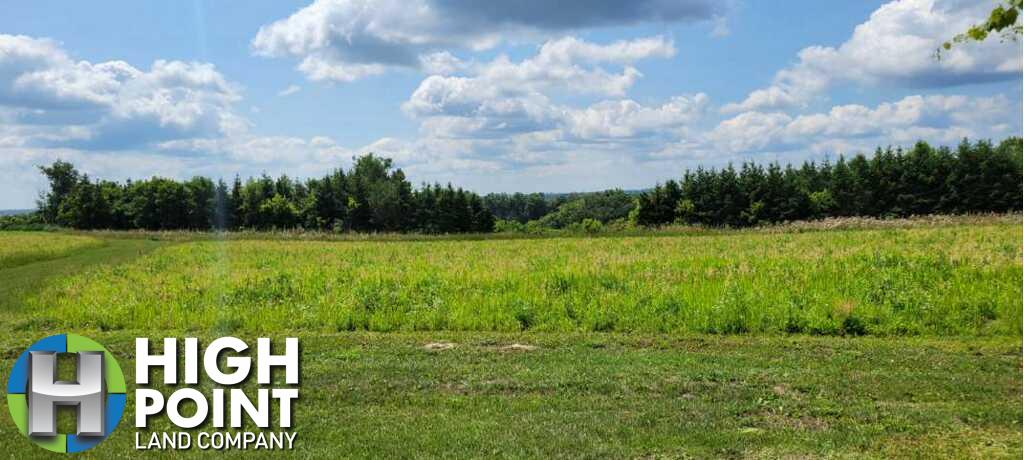
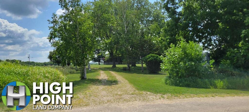
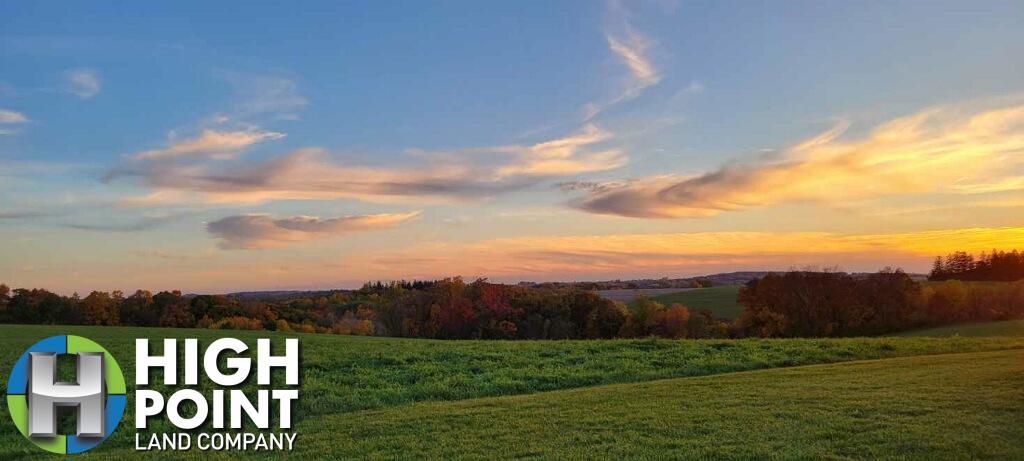
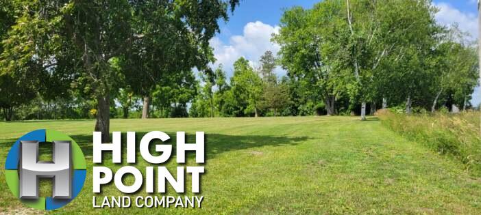
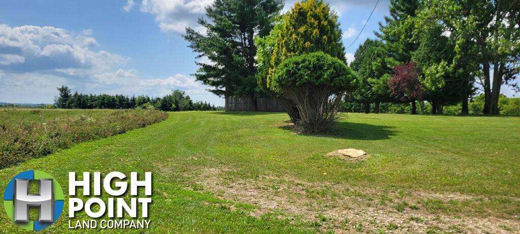
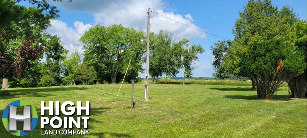
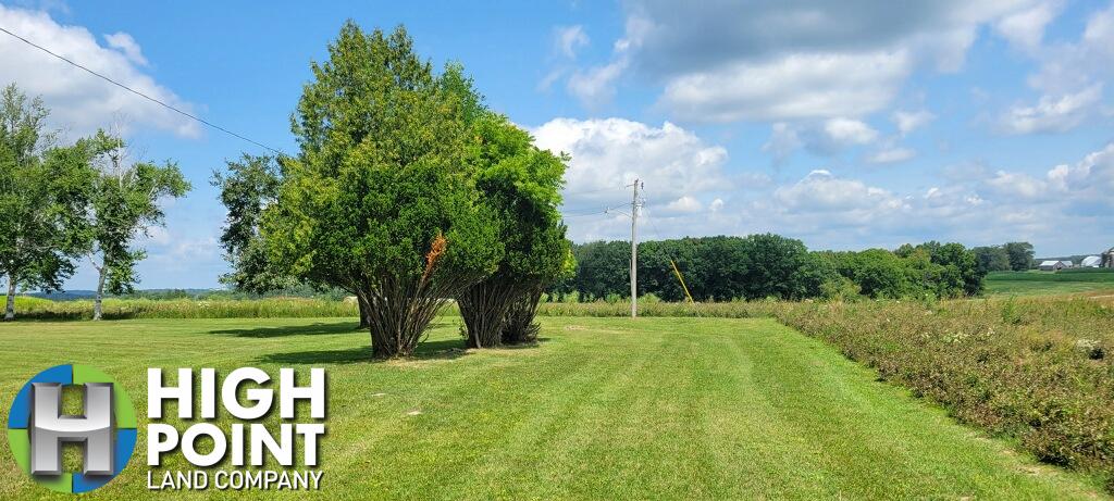
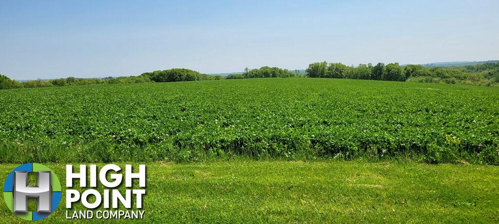
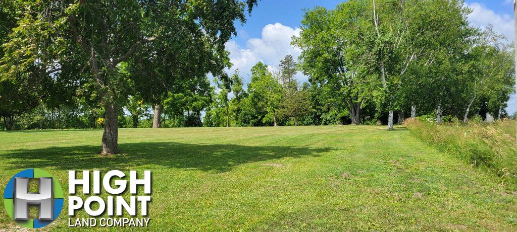
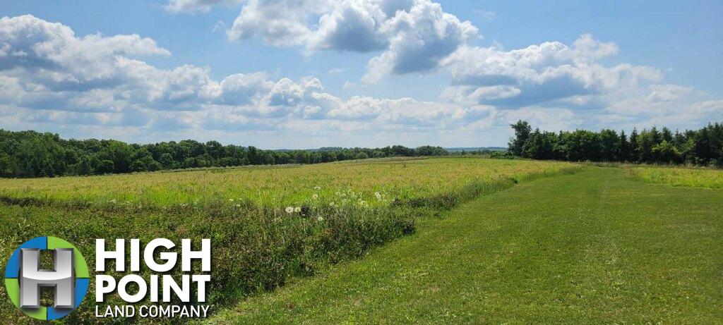
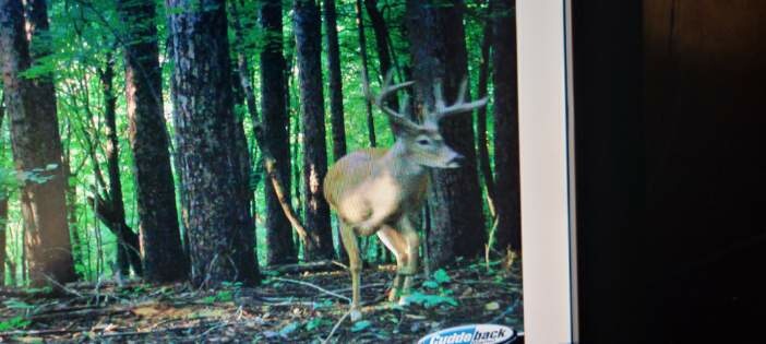
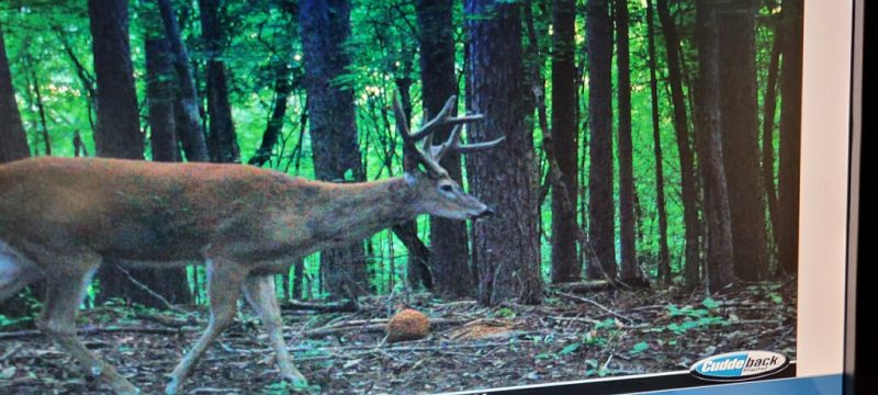
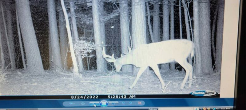
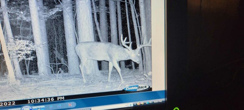
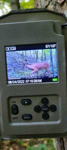
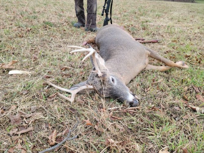
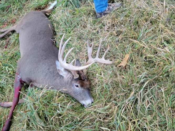
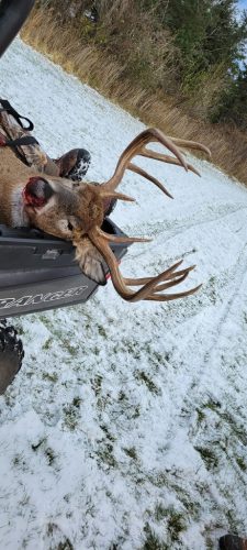
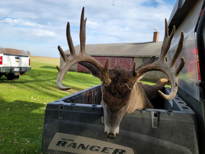
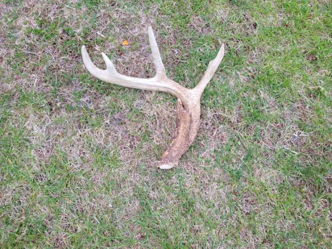
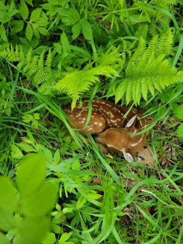
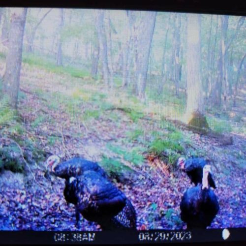
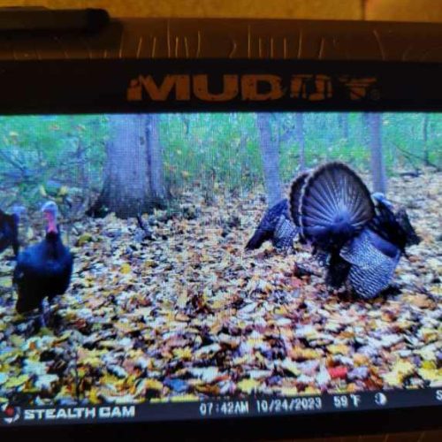
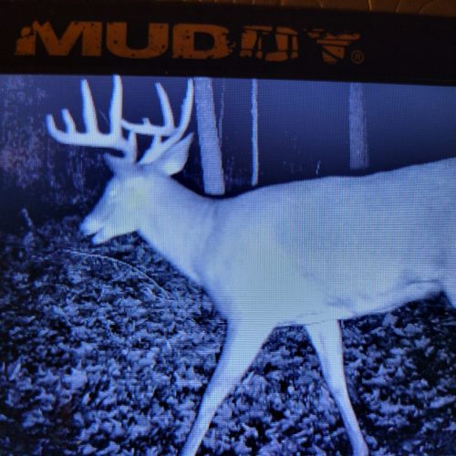
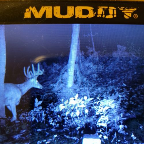
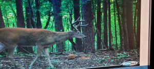
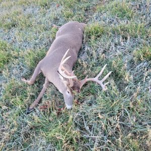
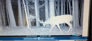
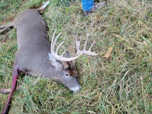
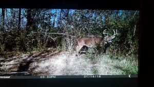
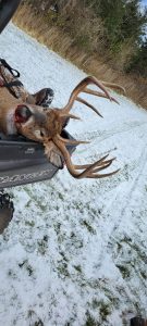
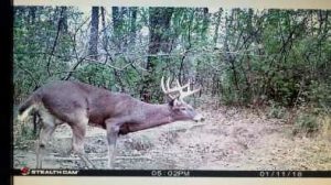
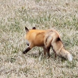
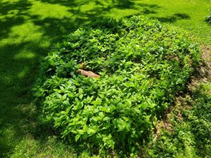
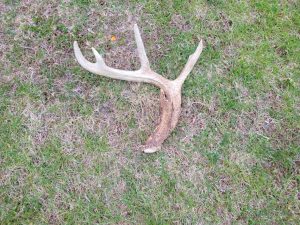
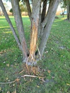
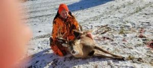
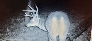
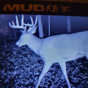
Located in northern Crawford County in the township of Utica you will find this 80.61-acre outdoor oasis. Rarely do income producing properties like this come to the market in this area! This property is generating over $10,000 per year in CRP payments along with an additional income from the rented organic tillable land on the property. As you enter the property from Stump Ridge Road you will wind back through rows of trees giving way to an old barn and breathtaking views. As you progress deeper into the land you will find a trailer that could be used as “deer camp” or a beautiful spot to build your forever home. There is no shortage of wildlife from deer, turkey, fox and many more calling this area home. The owners have harvested exceptional Whitetail deer from this property and this local neighborhood. If you are looking for your chance to own land in the driftless area you won’t want to miss this amazing property! Whether you are looking to hunt, hike, watch nature or escape the city this property has something for everyone!

If you would like your own personal showing call Wisconsin Land Specialist Eric Halvorson at 715-533-4904 or email at Eric@Highpointlandcompany.com.

Property Address:

50601 Stump Ridge Road, Viroqua, WI 54665

Property Features:

  • Stunning Views
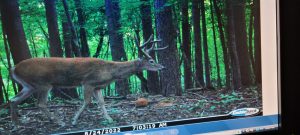
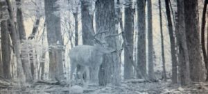
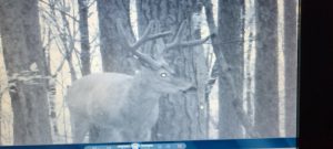
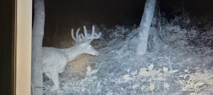
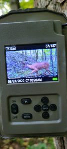
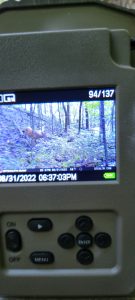
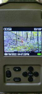
  • Great Deer History, Wildlife Galore!
  • Beautiful Building Sites
  • Income Generating Property
  • Well and Septic already in place. High speed internet available.

Driving Directions:

From Readstown,WI head West on US-14 for 1 mile. Turn Left onto Cty Hwy M. Travel 4 miles and then proceed left onto Solverson Rd for apprx. 1 mile. Take a slight left towards Stump Ridge Rd for apprx. 2 miles and property will be located on the left.

View Associated Files

Aerial Map

Soils Map

Topo Contours

Topo Hillshade

Topo Map

Wetlands Map